Earth orbits/Astronomy

In the diagram on the left, the black dashed line is the geosynchronous orbit. The green dashed line is the 20,230 km orbit used for Global Positioning System (GPS) satellites.
| English | Marker | Distance above earth (km) | Distance from center of earth (km) |
|---|---|---|---|
| Earth | Blue/brown image | 0 | 6370 |
| Low Earth Orbit (LEO) | Cyan area | 160 to 2,000 | 6,530 to 8,370 |
| Medium Earth Orbit (MEO) | Yellow area | 2,000 to 34,780 | 8,370 to 41,150 |
| International Space Station (ISS) | Red dotted line | 370 | 6,741 |
| Global Positioning System (GPS) satellites | Green dash-dot line | 20,230 | 26,600 |
| Geostationary Orbit (GEO) | Black dashed line | 35,794 | 42,164 |
Detector systems may be launched for extended periods either for suborbital Earth astronomy or Earth-orbit astronomy.
Lofting an observing system into an orbit around the Earth requires designing and testing for survival of the rocket trip upward and the orbiting technique (usually a second stage for orbital insertion).
Satellites
[edit | edit source]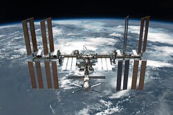
Def. a “man-made apparatus designed to be placed in orbit around a celestial body, generally to relay information, data etc. to Earth”[1] is called a satellite.
Skylab
[edit | edit source]
The student experiments performed on Skylab 3 included neutron analysis.
Van Allen probes
[edit | edit source]"The Radiation Belt Storm Probes [RBSP, NSSDC/COSPAR ID: 2012-046A, now the Van Allen Probes] mission is part of NASA's Living With a Star Geospace program to explore fundamental processes that operate throughout the solar system".[2]
International Space Station
[edit | edit source]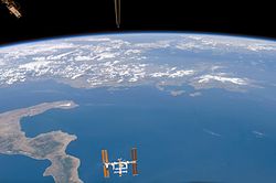


On the top right of this page is the International Space Station after the undocking of STS-134 Space Shuttle.
The Space Shuttle Endeavor crew captured this shot [on the left] of the International Space Station (ISS) against the backdrop of Planet Earth.
"Since 2001, NASA and its partners have operated a series of flight experiments called Materials International Space Station Experiment, or MISSE [on the second right]. The objective of MISSE is to test the stability and durability of materials and devices in the space environment."[3]
The Alpha Magnetic Spectrometer on the second left is designed to search for various types of unusual matter by measuring cosmic rays.
The Extreme Universe Space Observatory (EUSO) [on the third right] is the first Space mission concept devoted to the investigation of cosmic rays and neutrinos of extreme energy (E > 5×10¹⁹
eV). Using the Earth's atmosphere as a giant detector, the detection is performed by looking at the streak of fluorescence produced when such a particle interacts with the Earth's atmosphere.
On the lower left is a Bonner Ball Neutron Detector "BBND ... determined that galactic cosmic rays were the major cause of secondary neutrons measured inside ISS. The neutron energy spectrum was measured from March 23, 2001 through November 14, 2001 in the U.S. Laboratory Module of the ISS. The time frame enabled neutron measurements to be made during a time of increased solar activity (solar maximum) as well as observe the results of a solar flare on November 4, 2001."[4]
The Space Environment Data Acquisition equipment-Attached Payload (SEDA-AP) aboard the Kibo (International Space Station module) measures neutrons, plasma, heavy ions, and high-energy light particles in ISS orbit.
Aeronomy of Ice in the Mesosphere
[edit | edit source]
"The scientific purpose of the Aeronomy of Ice in the Mesosphere (AIM, [NSSDC/COSPAR ID: 2007-015A]) mission is focused on the study of Polar Mesospheric Clouds (PMCs) that form about 50 miles [60 km] above the Earth's surface in summer and mostly in the polar regions."[5]
Theoretical Earth-orbit astronomy
[edit | edit source]Low-earth orbit and geostationary orbit are two extremes.
Swarms
[edit | edit source]"Three [Swarm] satellites of the European Space Agency (ESA) have measured the magnetic field of Earth more precisely than ever before."[6]
Resurs-DK1
[edit | edit source]
The Payload for Antimatter Matter Exploration and Light-nuclei Astrophysics (PAMELA) is an operational cosmic ray research module attached to the Resurs-DK1 commercial Earth observation satellite.
HEAO 3
[edit | edit source]
The HEAO 3, launched on 20 September 1979 carried an experiment known as C1, which was a cryogenically cooled germanium (Ge) high-resolution gamma-ray spectrometer.
Explorer 45
[edit | edit source]
Explorer 45 (1971-096A) is a "NASA Small Scientific Satellite, S3-A ..., launched [using a Scout rocket on November 15, 1971,] from [the San Marco Platform,] Kenya, Africa, into an elliptical orbit having an apogee of 5.24 RE [27,031 km], a perigee of 220 km, an inclination of 3.5°, [eccentricity of 0.66982,] and a period of 7.82 hours. ... [carrying] two proton detectors and a three-axis fluxgate magnetometer. ... The lower energy proton instrument consists of an electrostatic analyzer-channeltron configuration measuring proton energies from 0.8 to 30 keV in 16 energy intervals."[7] Data stream ended on September 30, 1974,[8] and the satellite re-entered Earth's atmosphere on January 10, 1992.[9]
Interstellar boundary explorers
[edit | edit source]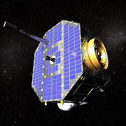

"The sensors on the IBEX spacecraft are able to detect energetic neutral atoms (ENAs) at a variety of energy levels."[10]
COMPTEL
[edit | edit source]
"In addition to observing gamma rays from a solar flare, [ the Imaging Compton Telescope] COMPTEL is also capable of detecting solar neutrons."[11]
INTEGRAL
[edit | edit source]"[P]ositron astronomy results ... have been obtained using the INTEGRAL spectrometer SPI".[12]
Velas
[edit | edit source]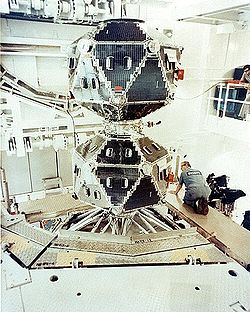
For gamma-ray astronomy, the Vela satellites were the first devices ever to detect cosmic gamma ray bursts.
Fermi Gamma-ray Space Telescope
[edit | edit source]
The Large Area Telescope (LAT) of the Fermi Gamma-ray Space Telescope detects individual gamma rays using technology similar to that used in terrestrial particle accelerators.
Explorer 11
[edit | edit source]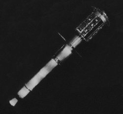
Explorer 11 (also known as S15) was an American Earth-orbital satellite that carried the first space-borne gamma-ray telescope. This was the earliest beginning of space gamma-ray astronomy. Launched on April 27, 1961 by a Juno II rocket the satellite returned data until November 17, when power supply problems ended the science mission. During the spacecraft's seven month lifespan it detected twenty-two events from gamma-rays and approximately 22,000 events from cosmic radiation.
Astro‐rivelatore Gamma a Immagini LEggero
[edit | edit source]AGILE (Astro‐rivelatore Gamma a Immagini LEggero) is an X-ray and Gamma ray astronomical satellite of the Italian Space Agency (ASI). [The] AGILE mission is ... to [observe] Gamma-Ray sources in the universe. ... AGILE’s instrumentation combines a gamma-ray imager (GRID) (sensitive in the energy range 30 MeV-50 GeV), a hard X-ray imager and monitor: Super-AGILE (sensitive in the range 18-60 KeV), a calorimeter (sensitive in the range 350 KeV-100 MeV) (MCAL), and an anticoincidence system (AC), based on plastic scintillator. AGILE was successfully launched on April 23, 2007.
Solrad 1
[edit | edit source]
The SOLar RADiation satellite program (SOLRAD) was conceived in the late 1950s to study the Sun's effects on Earth, particularly during periods of heightened solar activity.[13] Solrad 1 is launched on June 22, 1960, aboard a Thor Able from Cape Canaveral at 1:54 a.m. EDT. As the world's first orbiting astronomical observatory, Solrad 1 determined that radio fade-outs were caused by solar X-ray emissions.[13]
Solrad 3
[edit | edit source]

At left is an early X-ray observatory (Solrad 3), the spherical silver ball with antenna, atop a stack of satellites, being fitted with a nose cone to reduce atmospheric drag and to protect the satellites.
At right is the Thor Able Star rocket being launched by the US Air Force from Cape Canaveral, Florida, USA.
Solrad 3 is operated by the US Naval Research Laboratory beginning with its launch on June 29, 1961, through to the end of its mission on March 6, 1963. Although Solrad 3 did not successfully separate from the satellite immediately below it in the stack (Injun 1), it successfully returned solar X-ray data until late in 1961. It is not expected to re-enter the Earth's atmosphere for ~900 years.
European X-ray Observatory Satellite
[edit | edit source]Exosat is capable of observing an object (in the direct-pointing mode) for up to 80 hours and of locating sources to within at least 10 arcsec with the LEIT and about 2 arcsec with GSPC.[14]
Chandra X-ray Observatory
[edit | edit source]
On the right is a pictorial diagram for the Chandra X-ray Observatory, NSSDC ID 1999-040B, of some of the major satellite systems.
Array of Low Energy X-ray Imaging Sensors
[edit | edit source]The Array of Low Energy X-ray Imaging Sensors (ALEXIS) X-ray telescopes feature curved mirrors whose multilayer coatings reflect and focus low-energy X-rays or extreme ultraviolet light the way optical telescopes focus visible light. The Launch was provided by the United States Air Force Space Test Program on a Pegasus Booster on April 25, 1993.[15]
Far Ultraviolet Explorer
[edit | edit source]
"The Far Ultraviolet Spectroscopic Explorer (FUSE) ... detected light in the far ultraviolet portion of the electromagnetic spectrum, between 90.5-119.5 nanometres, which is mostly unobservable by other telescopes."[16]
Hubble Space Telescope
[edit | edit source]
The Hubble Space Telescope is an excellent example of a radiation satellite designed for more than one purpose: the various astronomies of optical astronomy.
Astrometry
[edit | edit source]On the right is an image from an animation that has the Gaia spacecraft spinning slowly (four revolutions per day) to sweep its two telescopes across the entire celestial sphere.
Lunar Atmosphere and Dust Environment Explorer
[edit | edit source]
"The Lunar Atmosphere and Dust Environment Explorer (LADEE, at left) launched 07 September 2013 at 03:27 UT (06 September 11:27 EDT) on a Minotaur-V from Wallops Flight Facility."[17]
STEREO spacecraft
[edit | edit source]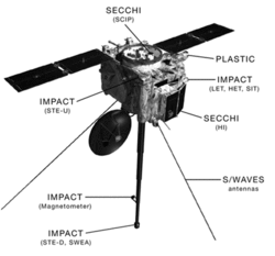
To produce 3D images of the Sun, the STEREO spacecraft [at right] take images in red and cyan.
Rosetta
[edit | edit source]
The Rosetta Spacecraft has two instruments aboard that use green astronomy: the Optical, Spectroscopic, and Infrared Remote Imaging System (OSIRIS) and the Visible and Infrared Thermal Imaging Spectrometer (VIRTIS).
Terras
[edit | edit source]
Composite images of the Sahara, a large yellow feature on Earth in the northern third of Africa, are mostly from the MODIS imager on board the Terra satellite.
Landsats
[edit | edit source]
LandSat 7 is one of the most recent of the LandSat series of Earth observing satellites. It produced an orange astronomy image of the Namib Desert.
Herschel Space Observatory
[edit | edit source]
"The camera operates in three bands centred on 70, 100, and 160 μm, respectively, and the spectrometer covers the wavelength range between 51 and 220 μm."[18]
Submillimeter Wave Astronomy Satellite
[edit | edit source]
The Submillimeter Wave Astronomy Satellite "is a NASA Small Explorer Project (SMEX) designed to study the chemical composition of interstellar gas clouds."[19]
Planck
[edit | edit source]The Planck telescope was launched to observe the Cosmic Microwave Background Radiation (CMBR).
Aquarius
[edit | edit source]
"Many natural sources, besides salinity, contribute to the microwave radiation at L-band frequencies (approximately 1 gigahertz) measured by satellites. Correcting the influence of these natural sources is a key to obtaining Aquarius’ accurate salinity measurements."[20]
TerraSAR-X
[edit | edit source]At the right is an artist's impression of the two radar satellites TerraSAR-X and TanDEM-X.
Aqua
[edit | edit source]

"Aqua [...] is a NASA Earth Science satellite mission named for the large amount of information that the mission is collecting about the Earth's water cycle, including evaporation from the oceans, water vapor in the atmosphere, clouds, precipitation, soil moisture, sea ice, land ice, and snow cover on the land and ice. Additional variables also being measured by Aqua include radiative energy fluxes, aerosols, vegetation cover on the land, phytoplankton and dissolved organic matter in the oceans, and air, land, and water temperatures."[21]
"It continues transmitting high-quality data from four of its six instruments, AIRS [Atmospheric Infrared Sounder], AMSU [Advanced Microwave Sounding Unit], CERES [Clouds and the Earth's Radiant Energy System], and MODIS [Moderate Resolution Imaging Spectroradiometer], and reduced quality data from a fifth instrument, AMSR-E [Advanced Microwave Scanning Radiometer-EOS]. The sixth Aqua instrument, HSB [Humidity Sounder for Brazil — VHF band], collected approximately nine months of high quality data but failed in February 2003."[21]
"Aqua follows a kind of polar orbit known as a Sun-synchronous orbit, which means it crosses the equator at the same local time during each pass. Aqua’s orbit ascends from south to north during the daylight hours, crosses near the North Pole, circles around Earth’s nighttime side, and crosses near the South Pole to return to the daytime side."[22]
Parasol
[edit | edit source]Parasol (Polarization & Anisotropy of Reflectances for Atmospheric Sciences coupled with Observations from a Lidar) was launched from Centre Spatial Guyanais (CSG) northwest of Kourou, French Guiana, on 18 December 2004 by an Ariane 5 G+.
« C’est un instrument qui sert à mesurer la direction et la polarisation de la lumière réfléchie par l’atmosphère dans diverses longueurs d’onde. »[23]
On the left are the intensity results for aerosols detected at 865 nm from March 2005 to February 2010.
Hypotheses
[edit | edit source]- Astronomy performed from extremely high-altitude powered flight, or a glider, is a form of Earth-orbit astronomy.
See also
[edit | edit source]References
[edit | edit source]- ↑ Widsith (June 19, 2012). satellite. San Francisco, California: Wikimedia Foundation, Inc. http://en.wiktionary.org/wiki/satellite. Retrieved 2012-08-10.
- ↑ Harlan E. Spence (August 16, 2013). Van Allen Probe A (RBSP-A). Washington, DC USA: National Space Science Data Center, NASA. http://nssdc.gsfc.nasa.gov/nmc/spacecraftDisplay.do?id=2012-046A. Retrieved 2014-01-07.
- ↑ Sheldon (April 29, 2011). Materials: Out of This World. Washington DC USA: NASA News. http://spacestationinfo.blogspot.com/2011_04_01_archive.html. Retrieved 2014-01-08.
- ↑ Tony Choy (July 25, 2012). Bonner Ball Neutron Detector (BBND). Johnson Space Center, Human Research Program, Houston, TX, United States: NASA. http://www.nasa.gov/mission_pages/station/research/experiments/BBND.html. Retrieved 2012-08-17.
- ↑ Dieter K. Bilitza (August 16, 2013). Aeronomy of Ice in the Mesosphere. Washington, DC USA: National Space Science Data Center, NASA. http://nssdc.gsfc.nasa.gov/nmc/spacecraftDisplay.do?id=2007-015A. Retrieved 2014-01-08.
- ↑ Christoph Seidler; translated by Anne-Marie de Grazia (19 June 2014). Earth's weakening magnetic field. Q-Mag.org. http://www.q-mag.org/earths-weakening-magnetic-field.html. Retrieved 2014-10-21.
- ↑ D. J. Williams; T. A. Fritz; A. Konradi (August 1973). "Observations of proton spectra (1.0≤ Ep≤ 300 keV) and fluxes at the plasmapause". Journal of Geophysical Research 78 (22): 4751-5. doi:10.1029/JA078i022p04751. http://onlinelibrary.wiley.com/doi/10.1029/JA078i022p04751/full. Retrieved 2013-06-22.
- ↑ H. Kent Hills (June 14, 2013). S-Cubed A. Greenbelt, Maryland USA: NASA Goddard Space Flight Center. http://nssdc.gsfc.nasa.gov/nmc/spacecraftDisplay.do?id=1971-096A. Retrieved 2013-06-22.
- ↑ Ed Grayzeck (June 14, 2013). S-Cubed A. Greenbelt, Maryland USA: NASA Goddard Space Flight Center. http://nssdc.gsfc.nasa.gov/nmc/spacecraftOrbit.do?id=1971-096A. Retrieved 2013-06-22.
- ↑ Dave McComas; Lindsay Bartolone (May 10, 2012). "IBEX: Interstellar Boundary Explorer". San Antonio, Texas USA: NASA Southwest Research Institute. Retrieved 2012-08-11.
- ↑ W. N. Johnson (November 1996). Appendix G to the NASA RESEARCH ANNOUNCEMENT for the COMPTON GAMMA RAY OBSERVATORY GUEST INVESTIGATOR PROGRAM. Greenbelt, Maryland USA: National Aeronautics and Space Administration Goddard Space Flight Center. http://heasarc.gsfc.nasa.gov/docs/cgro/nra/appendix_g.html#III.%20COMPTEL%20GUEST%20INVESTIGATOR%20PROGRAM. Retrieved 2013-04-05.
- ↑ G. Weidenspointner; G.K. Skinner; P. Jean; J. Knödlseder; P. von Ballmoos; R. Diehl; A. Strong; B. Cordier et al. (October 2008). "Positron astronomy with SPI/INTEGRAL". New Astronomy Reviews 52 (7-10): 454-6. doi:10.1016/j.newar.2008.06.019. http://www.sciencedirect.com/science/article/pii/S1387647308001164. Retrieved 2011-11-25.
- ↑ 13.0 13.1 TD Calderwood. Highlights of NRL's First 75 Years. http://www.nrl.navy.mil/NewsRoom/images/75highlights.pdf.
- ↑ Henry A. Hoff (August). "EXOSAT - The new extrasolar X-ray observatory". Journal of the British Interplanetary Society (Space Chronicle) 36 (8 1983): 363-7. http://adsabs.harvard.edu/abs/1983JBIS...36..363H.
- ↑ ALEXIS satellite marks fifth anniversary of launch. Los Alamos National Laboratory. 23 April 1998. http://www.fas.org/spp/military/program/masint/98-062.html. Retrieved 17 August 2011.
- ↑ D.J. Sahnow (1995-07-03). The Far Ultraviolet Spectroscopic Explorer Mission. http://fuse.pha.jhu.edu/papers/technical/aas95/aas95.html. Retrieved 2007-09-07.
- ↑ Richard C. Elphic; Sarah Noble; P. Butler Hine III (September 7, 2013). Lunar Atmosphere and Dust Environment Explorer (LADEE). Washington, DC USA: National Space Science Data Center, NASA. http://nssdc.gsfc.nasa.gov/nmc/spacecraftDisplay.do?id=2013-047A. Retrieved 2014-01-07.
- ↑ Edwin A. Bergin; Thomas Henning; Ewine van Dishoeck; Göran Pilbratt (January 30, 2013). Herschel sizes up massive protoplanetary disc. European Space Agency. http://sci.esa.int/science-e/www/object/index.cfm?fobjectid=51324. Retrieved 2013-02-01.
- ↑ 19.0 19.1 Brian M. Patten (June 28, 2005). The Submillimeter Wave Astronomy Satellite (SWAS). Cambridge, Massachusetts.: Harvard-Smithsonian Center for Astrophysics. http://www.cfa.harvard.edu/swas/. Retrieved 2012-08-05.
- ↑ Rosemary Sullivant (May 31, 2011). Aquarius Studying Our Salty Seas From Space. Pasadena, California USA: Jet Propulsion Laboratory, NASA. http://www.nasa.gov/mission_pages/aquarius/news/aquarius20110525.html. Retrieved 2014-01-08.
- ↑ 21.0 21.1 Steve Graham (2 June 2017). "Aqua Earth-observing satellite mission". Washington, DC USA: NASA. Retrieved 2017-06-19.
- ↑ Michon Scott (20 August 2009). Flying Steady: Mission Control Tunes Up Aqua's Orbit. Washington, DC USA: NASA. https://earthobservatory.nasa.gov/IOTD/view.php?id=39863&src=eoa-iotd. Retrieved 2017-06-19.
- ↑ Thérèse Barroso (19 January 2011). La mission du satellite Parasol pourrait être prolongée. CNES. https://cnes.fr/fr/web/CNES-fr/9044-gp-la-mission-du-satellite-parasol-pourrait-etre-prolongee.php. Retrieved 2017-06-19.
