Continental shelves/North Sea


"Eighteen thousand years ago, the seas around northern Europe were some 400 feet lower than today. Britain was not an island but the uninhabited northwest corner of Europe, and between it and the rest of the continent stretched frozen tundra. As the world warmed and the ice receded, deer, aurochs, and wild boar headed northward and westward. The hunters followed. Coming off the uplands of what is now continental Europe, they found themselves in a vast, low-lying plain."[1]
"Doggerland is now believed to have been settled by Mesolithic people, probably in large numbers, until they were forced out of it thousands of years later by the relentlessly rising sea. A period of climatic and social upheaval ensued until, by the end of the Mesolithic, Europe had lost a substantial portion of its landmass and looked much as it does today."[1]
"Based on seismic survey data gathered mostly by oil companies prospecting under the North Sea, [...] the contours [...] translate into gently rolling hills, wooded valleys, lush marshes, and lagoons."[1]
"In addition to the human jawbone, [there are] accumulated more than a hundred other artifacts —animal bones showing signs of butchery and tools made from bone and antler, among them an ax decorated with a zigzag pattern. Because [there are] coordinates of these finds, and because objects on the seabed tend not to move far from where erosion liberates them, [...] many come from a specific area of the southern North Sea that the Dutch call De Stekels (the Spines), characterized by steep seabed ridges."[1]
"The most rapid rises of sea level were on the order of three to six feet a century, but because of the variable topography of the land, the flooding would not have been even. In areas as flat as modern-day East Anglia, a six-foot rise could have shifted the coast inland by miles; in hillier places, less. Down in low-lying Doggerland, the rising sea turned inland lakes into estuaries."[1]
“There would have been huge population shifts. People who were living out in what is now the North Sea would have been displaced very quickly.”[2]
Northwest Britain[edit | edit source]

"Local Bathymetry and ocean currents [include in the image on the right] LSW:Labrador Sea Water; NADW:North Atlantic Deep Water; NSOW:Norwegian Sea Overflow Water)."[3]
"Sediments near the top of the Ling Bank Formation at its type locality have been correlated with ‘type’ Holsteinian sections in Denmark and Germany (Knudsen and Sejrup, 1993). However, it is still widely believed that marine Holsteinian deposits, in general, directly overlie the major erosion surface at the top of the Aberdeen Ground Formation (P915281). There was, therefore, a widespread glaciation during the Elsterian stage, which involved ice flowing from Scandinavia into the southern North Sea (Cameron et al., 1992) and extending to the continental shelf edge north-west of Scotland (Stoker et al., 1994)."[4]
"In the northern North Sea and on the West Shetland Shelf a widespread surface of marine erosion has been correlated with the OIS 4/3 boundary. It is overlain by the mainly arctic marine Cape Shore Formation, which is securely placed in the Middle Weichselian on several lines of evidence (Johnson et al., 1993; Skinner et al., 1986; Sejrup et al., 1994; Holmes, 1997). Thus the seas to the north and west of Scotland were also free of glacier ice during this stage and perhaps much of the Scottish mainland."[4]
"At Clava, near Inverness, rafts of highboreal to low-arctic shallow marine mud originally deposited in Loch Ness, then a fjord, are probably early to middle Devensian in age (Merritt, 1992). The deposits correlate with those of the Bø Interstadial in Norway on amino-acid dating evidence (P915290). Rafts of broadly similar age have been located at the Boyne Limestone Quarry, King Edward and Gardenstown sites."[4]
An "ice sheet [may have] extended to the continental shelf break, and beyond, to the north and west of Scotland (Holmes, 1991; Stoker and Holmes, 1991; Stoker et al., 1993; P915288). The resultant sediments are correlated on the basis of regional seismostratigraphy with Late Weichselian (OIS 2) deposits in the northern North Sea (Johnson et al., 1993). A radiocarbon date of about 22.5 ka BP from glaciomarine deposits within the limit of glaciation on the outer shelf to the west of St Kilda (Selby, 1989) appears to be consistent with the Late Devensian glacial maximum predating 18 ka BP (P915288)."[4]
"Warm North Atlantic waters did not reach the north-east Atlantic and western Scotland until about 13 ka BP, when conditions changed from high arctic to boreal possibly in less than 50 years (Kroon et al., 1987; Peacock and Harkness, 1990)."[4]
"The return of warm North Atlantic Drift waters to the Scottish seas occurred within a few decades just prior to 10,100 BP (Peacock and Harkness, 1990). At first sea temperatures were 2 to 3° lower than those of the present day, but a warming occurred at about 9600 BP."[4]
Stratigraphy[edit | edit source]

Most "of the southern North Sea was low-lying land like the Netherlands until the first major glaciation. Moraines are preserved at the shelf-edge north-west of mainland Scotland, more than 60 km west of the nearest coastline (Holmes et al., 1993; Stoker et al., 1993). Conversely, marine deposits are preserved more than 10 km inland from the modern coastline at the head of the Moray Firth and at least 6 km inland near Elgin."[4]
"At least five major glacial episodes have been recognised in the North Sea basin, within a sequence that is dominanted by deltaic, low salinity cold-water marine and glaciomarine conditions (Sutherland, 1984a). The thickest and most complete sequence (more than 500 m) is preserved in the Central Graben of the North Sea, which has subsided tectonically throughout the Quaternary. At least ten till units are present within the Norwegian Channel with six or seven extending to the distal shelf break (Sejrup et al., 2000)."[4]
Scottish Highlands[edit | edit source]
"To the north and west of 58°N 01°E, the unconformity is interpreted from 3-D seismic evidence to take the form of fluvial channels. These features merge downslope into furrowed surfaces like those known to have been produced by grounded icebergs or sea-ice keels (Holmes, 1997). This evidence for ice scour within the Aberdeen Ground Formation is reinforced by the occurrence of periodic ice-rafted debris in sequences of equivalent age on the Atlantic margins off north-west Scotland (Stoker et al., 1994). Hence, the Scottish Highlands were probably glaciated to some extent during the colder stages of the Early Quaternary before 1.2 Ma."[4]
"The oldest known glacial deposits laid down offshore by ice flowing from the Scottish Highlands have been found in boreholes in the Forth Approaches and the Moray Firth (Stoker and Bent, 1985; Bent, 1986). There, towards the top of the Aberdeen Ground Formation, glaciomarine sediments laid down by a grounded ice sheet occur in the west, with the facies becoming increasingly more distal to the east. The deposits lie immediately above the Brunhes–Matuyama palaeomagnetic boundary (P915280; P915341) suggesting that the glaciation occurred in OIS 18, within the Cromerian Complex."[4]
Northern North Sea[edit | edit source]
"In the northern North Sea, the Shackleton Formation (Johnson et al., 1993) [Early Quaternary glaciations (1.2 to 0.78 Ma)] includes an erosion surface that separates sand-rich sediments below from mud-rich sediments above. The incoming of mud-rich sediments is reflected by a change of acoustic facies that is tentatively attributed by Johnson et al. (1993) to the first impact of regional glaciation [Menapian/Bavelian, see image in Stratigraphy] on the depositional environment of the northern North Sea."[4]
On "the basis of seismostratigraphical correlation, it predates the 1.07 to 0.99 Ma Jaramillo Subchron (P915280), which has been reported from the overlying Mariner Formation (Stoker et al., 1983; compare with Skinner et al., 1986)."[4]
Evidence occurs "in the Troll region of the Norwegian Channel for the ‘Fedje Glaciation’, which postdates the 1.19 Ma Cobb Mountain Event within the Matuyama Reversed Polarity Chron (Funnell, 1995; P915341). On the basis of the micropalaeontology, Sr-isotopes, palaeomagnetism and amino-acid geochronology, this glaciation has been assigned an age close to 1.1 Myr (Sejrup et al., 1995)."[4]
"The presence of the diamicton, the geometry of the reflector and other evidence have been put forward as evidence of shelf glaciation extending from Norway across the northern North Sea to areas west of Shetland (Holmes, 1997)."[4]
"The earliest evidence for glaciation of the sea bed offshore from north-east Scotland occurs in the Fladen area of the central North Sea where a 10 m-thick unit of diamicton lies just above the Jaramillo Subchron within the Aberdeen Ground Formation. As the diamicton is overlain by sediment containing microfossils with an interglacial aspect provisionally correlated with the Leerdam Netherlands Pollen Stage, Sejrup et al. (1987) place the glacial event within the Bavelian Complex, between 800 and 900 ka."[4]
"Evidence for Saalian glaciations off north-east Scotland occurs in the Fisher and Coal Pit formations. The predominantly arctic glaciomarine Fisher Formation rests on a major, gently undulating unconformity that cuts across (onlaps) the Ling Bank and Aberdeen Ground formations (P915280, P915281). The unconformity results from a marine transgression and the overlying Fisher Formation is thought to be no older than OIS 7 (Jensen and Knudsen, 1988; Holmes, 1997). A till has been identified within the Fisher Formation (Sejrup et al., 1987) and contemporaneous subglacial erosion is thought to have occurred to the north of 58.6°N in the Moray Firth (Bent, 1986). The top of the Fisher Formation is defined by another regional unconformity, but unlike the one at its base, this one is typically crenulate (P915281) and is believed to be the result of the Saalian glaciation (Gatliff et al., 1994). The channels are mainly infilled with glaciomarine deposits belonging to the overlying Coal Pit Formation (Sejrup et al., 1987), although some fragmentary beds deposited in warmer waters have been identified within the formation in the northern and central North Sea (Gatliff et al., 1994)."[4]
"The glaciomarine basal deposits of the Coal Pit Formation are succeeded by marine sediments containing foraminiferal assemblages typical of the Eemian–Ipswichian Interglacial (Cameron et al., 1987). These in turn underlie a horizon that has been correlated with the palaeomagnetic Blake Event at the OIS 5e/5d boundary (Stoker et al., 1985)."[4]
Ice "flowing from the mainland affected the northern North Sea at least as far south as 56°N (Sutherland and Gordon, 1993) and it reached the shelf break to the north-west of Scotland (Skinner et al., 1986; Stevenson, 1991; Holmes, 1997)."[4]
"The Wee Bankie Formation (Stoker et al., 1985) lies directly off the east coast of Scotland. It has a sheet-like geometry with an uneven, ridged top and comprises up to 40 m of stiff, matrix-dominated diamicton with some interbeds of sand, pebbly sand and silty clay."[4]
"The Wee Bankie Formation is replaced eastwards by the Marr Bank Formation, commonly at a low, eastward-facing scarp interpreted as a former ice-contact slope, but the two formations probably interdigitate locally (Stoker et al., 1985). The Marr Bank Formation consists mostly of sands and muddy sands of Scottish provenance with a sparse microfauna indicative of shallow, high boreal to arctic waters. It forms a sheet-like deposit up to 25 m thick resting on an extensive surface of marine planation dipping north-eastwards (Holmes, 1977). As it is traced eastwards, the basal reflector of the Marr Bank Formation becomes acoustically indistinguishable from the upper part of the adjacent Coal Pit Formation, and the two formations probably pass laterally into one another locally (Gatliff et al., 1994)."[4]
"Much of the northern North Sea north of 58°N had been deglaciated by 16 to 14 ka BP, and was either subaerially exposed or inundated by a very shallow sea (Peacock, 1995). This is compatible with a maximum age of about 14.1 ka BP for the onset of glaciomarine sedimentation following retreat of ice from the Witch Ground area (P915291; Sejrup et al., 1994) and at about 15 ka BP in the Norwegian Channel (Sejrup et al., 1995). The onset of deglaciation on the Hebridean Shelf has been dated to about 15.2 ka BP, predating the onset of warming in the North Atlantic (Peacock et al., 1992; Austin and Kroon, 1996). Shells within glaciomarine sediments occurring onshore near Peterhead have yielded ages of about 14.3 and 14.9 ka BP (St Fergus)."[4]
"Radiocarbon dates from Portlandia arctica Gray, a high arctic marine bivalve, indicate that polar water, and probably seasonal sea-ice, remained in the northern North Sea until at least 13.2 to 13.1 ka BP when warmer waters arrived. Glaciomarine and estuarine silts and clays of the Errol Formation accumulated along the coasts (Peacock, 1999), while the muddy St Abbs Formation was laid down in this polar sea off the eastern coast of Scotland (Stoker et al., 1985; P915281)."[4]
"A record of the Windermere Interstadial is probably contained within the Swatchway Formation, which occurs to the north-east of Buchan (P915281). It comprises shelly muds and sands with a mixed northern temperate to arctic microfauna (Stoker et al., 1985; Harland, 1988). It occurs more certainly in the Largo Bay Member of the Forth Formation, which is more widespread off north-east Scotland (Stoker et al., 1985; P915281). It includes up to 30 m of silty muds that become coarser grained and pebbly upwards with concomitant decreasing faunal diversity. The trends probably reflect lowering sea level and cooling seas towards the onset of the Loch Lomond Stadial. The overlying St Andrews Member was laid down as coastal sand bars in a very shallow sea during the subsequent Loch Lomond Stadial. High arctic marine fauna returned during the stadial, during which nearshore marine summer temperatures were approaching 10° below present levels (Graham et al., 1990; Peacock, 1996)."[4]
Central North Sea[edit | edit source]

"A record of the Eemian (Ipswichian) is contained within the central part of the Coal Pit Formation, which fills channels that were probably eroded during, or immediately after, the Saalian glaciation in the Moray Firth and central North Sea (Andrews et al., 1990; Gatliff et al., 1994; P915281)."[4]
"In southern Norway, the Eemian is now thought to have been succeeded by a prolonged period of interstadial conditions with restricted mountain glaciation (Sejrup et al., 2000)."[4]
An "ice stream occupied the Norwegian Channel after 80 ka, suggesting that a regional glaciation occurred equivalent to the Karmoy Glaciation established in south-west Fennoscandia (P915290). Micromorphological studies of sediments from several boreholes in the central North Sea also suggest regional glaciation at that time involving coalescing Scottish and Scandinavian ice sheets (Carr, 1998)."[4]
"The Coal Pit Formation in the central North Sea includes a sequence of shelly glaciomarine clays that have been placed tentatively in OIS 3 on palaeomagnetic evidence (Stoker et al., 1985) indicating that this area was free of glacier ice during this stage."[4]
"In the central North Sea, the lower part of the Swatchway Formation, at Borehole 77/2 (P915291), is formed mainly of glaciomarine sediments from which AMS radiocarbon dates of 22.7, 20.9 and 19.7 ka BP have been obtained on in situ mollusc and benthic foraminiferids (Sejrup et al., 1994). This evidence suggests that the area was free of grounded ice during that period. However, a diamicton underlying the glaciomarine deposits in that borehole is interpreted as a till (Sejrup et al., 1994). It contains reworked arctic benthic foraminiferids that have provided a maximum AMS radiocarbon age of 42.3 ka BP. The diamicton rests on cold marine deposits assigned to the Ålesund Interstadial of north-west Fennoscandia and it is concluded by Sejrup et al. (1994) that the till was laid down between 28 ka BP and 22 ka BP during an initial, maximal stage of the Late Devensian glaciation."[4]
The "central North Sea was also glaciated in the previous Skjonghelleren Glaciation of Fennoscandia, between about 50 and 40 ka BP (P915290)."[4]
The "Scottish and Scandinavian ice sheets reached their maximum extent in the Late Devensian prior to about 22 ka BP and that they very probably coalesced (P915288). At least the uppermost part of the Wee Bankie Formation postdates this early phase. Following retreat to an unknown position at about 20 ka BP, during the Hamnsund Interstadial of Norway (Valen et al., 1996), the Scottish ice sheet probably then re-advanced to the eastern boundaries of the ‘Bosies Bank Moraine’ (Bent, 1986; P915291). This event probably equates with the Tampen Glaciation of Norway, when ice re-advanced onto the shelf and an ice stream reoccupied the Norwegian Channel (Sejrup et al., 2000; P915290)."[4]
Southern North Sea[edit | edit source]

"The top of the Aberdeen Ground Formation is cut by a succession of isolated, anastomosing and locally stacked channels, some of which may have been formed as sub-glacial or ice-marginal ‘tunnel’ valleys. The channels, together with the oldest units of sediment contained within them (Ling Bank Formation), have been correlated on the basis of regional seismostratigraphy with the widespread Elsterian glaciation of the north-west European mainland (Stoker et al., 1985; Cameron et al., 1987)."[4]
"The channelled surfaces at the top of the Aberdeen Ground Formation may well have formed in more than one glacial cycle, including the severe Cromerian glaciation of OIS 16 (Holmes, 1997). It follows that the first major interruption of the growth of deltas across the southern North Sea may have occurred in the Cromerian and not the Elsterian as commonly believed (P915341)."[4]
Wadden Sea[edit | edit source]

"The area presents the world’s largest coherent intertidal flats: 4700 km2 emerge during low tide."[5]
"The Wadden Sea extends roughly 500 km along the southeast coast of the North Sea from Den Helder in The Netherlands to Blåvands Huk in Denmark [see the image on the right]. A large part of the intertidal area is sheltered by barrier islands and sand bars against the surf of the North Sea."[5]
"The total area of the islands is about 2000 km2 and the Wadden Sea itself covers about 8000 km2."[5]
"Some 18,000 years ago, at the last glacial maximum, the sea-level in the region was about 125 m lower than it is today (Streif, 2004). In contrast with the previous Saale glaciation, the region was not covered with ice during this Weichselian glaciation. The Pleistocene landscape of the Wadden Sea Region has been formed both by glacial processes e.g. in the form of terminal moraines and by glaciofluvial processes e.g. in the form of outwash plains formed by the melting water from the Weichselian ice sheet. Some of the 16 present barrier islands have developed attached to local heights in the Pleistocene landscape. The islands Texel (The Netherlands), Amrum, Föhr and Sylt (Germany) have outcrops of Pleistocene sediments."[5]
"After the last Ice Age, melting of the Fennoscandian and Canadian ice shields caused the sea-level to rise rapidly. Initially, the rate of sea-level rise was too high to allow the formation of a barrier island system. Although there are some indications that the first barrier islands formed approximately 8000 years BP it was primarily when the rate of sea-level rise decreased to well below 10 mm/y that the present-day landscape started to form (Streif, 2004). From 5000 BP the sea-level rise slowed to 1e2 mm per annum, and crustal adjustments in response to the unloading of the ice pressure in Scandinavia caused the land in the Wadden Sea Region to sink gradually by about 1 mm per year (Vink et al., 2007). At the start of the formation of the Wadden Sea system much of the sediment forming the Wadden Islands originated from the bottom of the newly inundated North Sea. In the later development of the barrier islands the longshore sediment transport also played an important role."[5]
Dollart[edit | edit source]


The Dollart Bay was created by a catastrophic storm surge in 1277,[6] covering the district of Reiderland and large parts of the Oldambt district. The flood inundated 43 parishes, and is estimated to have caused 80,000 deaths.[7] Another storm surge in 1509 further extended the Dollart, flooding 30 more villages,[8] and by 1520 the Dollart had its largest extension.
Heligoland[edit | edit source]


The recent history period dates from around 1,000 b2k to present.
Heligoland is a small archipelago in the North Sea.[9] A part of the German state of Schleswig-Holstein since 1890, the islands were historically possessions of Denmark, then became the possessions of the United Kingdom from 1807 to 1890, and briefly managed as a war prize from 1945 to 1952.
The islands are located in the Heligoland Bight (part of the German Bight) in the southeastern corner of the North Sea. They are the only German islands not in the vicinity of the mainland. They lie approximately 69 kilometres (43 miles) by sea from Cuxhaven at the mouth of the River Elbe.
The German Bight and the area around the island are known to have been inhabited since prehistoric times. Flint tools have been recovered from the bottom of the sea surrounding Heligoland. On the Oberland, prehistoric burial mounds were visible until the late 19th century, and excavations showed skeletons and artifacts. Moreover, prehistoric copper plates have been found under water near the island; those plates were almost certainly made on the Oberland.[10]
The island of Heligoland is a geological oddity; the presence of the main island's characteristic red sedimentary rock in the middle of the German Bight is unusual. It is the only such formation of cliffs along the continental coast of the North Sea. The formation itself, called the Bunter sandstone or Buntsandstein, is from the early Triassic geologic age. It is older than the white chalk that underlies the island Düne, the same rock that forms the white cliffs of Dover in England and cliffs of Danish and German islands in the Baltic Sea. In fact, a small chalk rock close to Heligoland, called witt Kliff[11] (white cliff), is known to have existed within sight of the island to the west until the early 18th century, when storm floods finally eroded it to below sea level.
Heligoland's rock is significantly harder than the postglacial sediments and sands forming the islands and coastlines to the east of the island. This is why the core of the island, which a thousand years ago was still surrounded by a large, low-lying marshland and sand dunes separated from coast in the east only by narrow channels, has remained to this day, although the onset of the North Sea has long eroded away all of its surroundings. A small piece of Heligoland's sand dunes remains—the sand isle just across the harbour called Düne (Dune). A referendum in June 2011 dismissed a proposal to reconnect the main island to the Düne islet with a landfill.[12]
"Today [14 August 2008], Helgoland is a small rocky island with an exposed rocky shore located in the German Bight (SE North Sea)."[13]
"Old maps show that only 1200 years ago [808 AD, 1192 b2k] Helgoland was much larger and muddy tidal flats surrounded the island."[13]
"This study is based on 1 cm-resolution granulometric data of 5 sediment cores (5 m core length, covering the past millennium) taken from the west, the center, and the east of the HMA, data of a parametric subbottom profiler, a RoxAnn seafloor-classification system, and AMS radiocarbon data."[13]
"In order to detect the source of the fine sediments in a likewise classical sandy North-Sea environment, morphologic features such as the adjacent "Helgoland Hole" west of the HMA that exceeds the ambient water depth by 100%, and the sediment geometries as revealed by shallow seismics were studied. In many transects shot with the SES2000 parametric echosounder, vertically interrupted layers suggest gas in the sediment that locally extends up to the surface. Transects from the SW of the working area reveal north-inclined layers suggesting sediment discharge from the south, which would also explain why the "Helgoland Hole" is still an open depression. Transects from the southern part of the HMA show large sandwaves that likely were buried and fossilized during a dramatic discharge of sediment. All evidence including the general water-mass circulation in this part of the North Sea thus points to a southern rather than a northern (i.e. former mud flats of Helgoland) source for the muddy sediments. It is concluded that the sediment that fills the HMA originated mostly from rivers such as the Elbe, and the Wadden Sea. Variations in grain size are due to fluctuations in the predominant wind direction and speed, and due to anthropogenic action such as dike-construction measures during the past centuries."[13]
German Bight[edit | edit source]

,_Elbe,_Trischen.jpg)
The German Bight, sometimes called the German Bay, is the southeastern bight of the North Sea bounded by the Netherlands and Germany to the south, and Denmark and Germany to the east (the Jutland peninsula). To the north and west is the Dogger Bank.
The Bight contains the Frisian and Danish Wadden Sea Islands. The Wadden Sea is approximately ten to twelve kilometres wide at the location of the German Bight.[14] The Frisian islands and the nearby coastal areas are collectively known as Frisia. The southern portion of the bight is also known as the Heligoland Bight. Between 1949 and 1956 the BBC Sea Area Forecast (Shipping Forecast) used "Heligoland" as the designation for the area now referred to as German Bight.
Roskilde Fjords[edit | edit source]


The "Blytt-Sernander climatic zones [Boreal (dry), Atlantic (humid), Subboreal (dry and warm) and Subatlantic (humid and cool), with the Atlantic period divided in two zones the Early Atlantic Period and the Full Atlantic Period (Jessen 1937, Jørgensen 1963)] show up clearly in the lithology (chemical analysis) of the marine core (RF6). Furthermore, the lithological changes are synchronous with the shift in pollen zones. [...] the inner part of Roskilde Fjord is configured as an evaporation pan, in the middle of Sjælland, with fluctuating inflows of seawater and freshwater. [...] the Blytt-Sernander climatic zones have been established using the traditional pollen indicators namely the distinct elm-fall at the Full Atlantic/Subboreal transition, and the rise of Beech at the Subboreal/Subatlantic transition. In dating the zones, we follow the investigations in Store Bælt (Christensen et al. 1997). However, 14C datings in RF6 of both the top of Boreal (AAR-3347) and the bottom of Early Atlantic (AAR-3346) confirmed the date of 7000 BC. Similarly, dating the elm-fall in both RF6 (AAR-3345) and Lake Kornerup (AAR- 6263) confirmed the date of 3800 BC."[15]
Late Middle Ages[edit | edit source]
The Late Middle Ages extends from about 700 b2k to 500 b2k.
"During the late Middle Ages (a.d. 1000–1500), increased storm surges and tidal incursions allowed for extensive progressive erosion of inhabited peatlands, transforming the central Netherlands into the Zuyder Zee tidal lagoon. In the north-eastern quadrant of the expanding water body, medieval terrestrial geological and archaeological records fell prey to erosion, re-working and uptake into lagoon-floor deposits. These deposits have been intensively surveyed since the 1940s when the quadrant was reclaimed and made into arable land, and are revealed to contain spatially clustered late medieval archaeological objects."[16]
Little Ice Age[edit | edit source]

The Little Ice Age (LIA) appears to have lasted from about 1218 (782 b2k) to about 1878 (122 b2k).
"The populated 1.0 km² main island (Hauptinsel) to the west and the Düne to the east, which is somewhat smaller at 0.7 km², as well as lower, and surrounded by sand beaches. They were connected until 1720, when the natural connection was destroyed by a storm flood."[17]
A "climate interpretation was supported by very low δ’s in the 1690’es, a period described as extremely cold in the Icelandic annals. In 1695 Iceland was completely surrounded by sea ice, and according to other sources the sea ice reached half way to the Faeroe Islands."[18]
In the image at the top, "before present" is used in the context of radiocarbon dating, where the "present" has been fixed at 1950. The apparent decreases in solar activity are called the "Maunder Minimum", "Spörer Minimum", "Wolf Minimum", and "Oort Minimum".
"Northern Hemisphere summer temperatures over the past 8000 years have been paced by the slow decrease in summer insolation resulting from the precession of the equinoxes."[19]
Precisely "dated records of ice-cap growth from Arctic Canada and Iceland [show] that LIA summer cold and ice growth began abruptly between 1275 and 1300 AD, followed by a substantial intensification 1430-1455 AD. Intervals of sudden ice growth coincide with two of the most volcanically perturbed half centuries of the past millennium. [Explosive] volcanism produces abrupt summer cooling at these times, and that cold summers can be maintained by sea-ice/ocean feedbacks long after volcanic aerosols are removed. [The] onset of the LIA can be linked to an unusual 50-year-long episode with four large sulfur-rich explosive eruptions, each with global sulfate loading >60 Tg. The persistence of cold summers is best explained by consequent sea-ice/ocean feedbacks during a hemispheric summer insolation minimum; large changes in solar irradiance are not required."[19]
"At the same time the sortable-silt mean grain size increased suggesting a higher energetic level with regard to currents and waves. At the end of the LIA the sediments show a fining trend again. The changes in grain size likely mirror the frequency and strength of severe storms during the LIA including a calmer period during the Maunder Sun-Spot Minimum (around AD 1700) that was most likely characterized by an increased number of calmer negative NAO situations."[13]
High Middle Ages[edit | edit source]
The High Middle Ages date from around 1,000 b2k to 700 b2k.
"The first large-scale dike building activities commenced during the High Middle Ages, from the 11th to the 13th century. This marked a significant change in the relationship between man and nature. Whereas previously the sea flowed freely over the whole region during storm tides, it was now shut out. This provided an enormous boost to habitation and agriculture but when storm surges broke through dykes, people and cattle drowned in high numbers. These disasters were perceived as God’s aversion towards human wealth and corruption of moral standards, and had a lasting imprint on the mentality of the coastal population (Jakubowski-Tiessen, 2011)."[5]
"Next to the building of dykes, the large-scale exploitation of the extensive peat lands between the clay areas and the sandy areas in the High Middle Ages also had a major impact on the coastal environment. In terms of water management, the construction of dykes and the exploitation of the peatlands cannot be considered separately (De Jonge, 2009). The exploitation together with the oxidising of the peat caused lowering of the level of the mainland behind the dykes which became a permanent challenge for drainage. Salt and peat mining also substantially contributed to the lowering of the marsh surface below the level of the sea."[5]
Medieval Warm Period[edit | edit source]


The Medieval Warm Period (MWP) dates from around 1150 to 750 b2k.
"A proof-of-concept self-calibrating chronology [based upon the Irish Oak chronology] clearly demonstrates that third order polynomials provide a series of statistical calibration curves that highlight lacunae in the samples."[20]
As indicated in the figures, the data used in the plots comes from radiocarbon dating of Irish Oaks.[21]
Gaps occur near the 1070s and 1470s b2k during the rising Δ14C values.
"The number of suitable samples of wood, which connect Antiquity and the Middle Ages is very small [shown in the first figure on the left]. But only a great number of samples would give certainty against error. For the period about 380 AD we have only 3, for the period about 720 AD only 4 suitable samples of wood (Hollstein 1980,11); usually 50 samples serve for dating."[22]
"The center of the graph [in the second image on the left] shows the time axis of conventionally dated historical events. Upper and lower coordinates show reconstructed time tables. The black triangles mark the phantom years."[22]
"In Frankfurt am Main archaeological excavations did not find any layer for the period between 650 and 910 AD."[22]
"According to earlier studies this land mass [Helgoland] disintegrated before AD 1250 [750 b2k] and the muddy sediments appear to have filled a depression in the southeast of the island. This area, the "Helgoland Mud Area" (HMA, 20-30 m of water depth), covers about 500 km2 forming one of the few muddy sediment spots in the North Sea. It can be anticipated that these sediments carry a record that is instrumental in paleoenvironment reconstructions of the past millennium."[13]
"The sediment cores reveal high sedimentation rates (11 mm/a) during the Medieval Warm Period that decrease by 50% at the beginning of the Little Ice Age (LIA, AD 1350-1900 [650 b2k - 100 b2k])."[13]
After this relatively short cool interlude the climate ameliorated again and reached between 800 and 1200 almost the values of the Roman Warm Period (used temperature proxies are sediments in the North Atlantic).[23] This warming happened during the High Middle Ages wherefore this event is known as Medieval Global Warming or the Medieval Warm Period. This warmer climate peaked around 850 AD and 1050 AD, and raised the tree line in Scandinavia and in Russia by 100 to 140 meters;[24] it enabled the Vikings to settle in Iceland and Greenland.
Early Middle Ages[edit | edit source]
The Early Middle Ages date from around 1,700 to 1,000 b2k.
"During the Early Middle Ages, the Dollard area was a relatively high area consisting of salt-marshes and raised coastal peat bogs [...]. The salt-marshes were occupied in those days; the inhabitants lived on dwelling mounds."[25]
"After 2000 BP the sea broke into the salt-marsh and peat areas and new tidal systems such as the Dollard (800–400 BP) were formed."[25]
In the 19th century the Early Middle Ages were often labelled the Dark Ages, a characterization based on the relative scarcity of literary and cultural output from this time.[26]
Dark Ages Cold Period[edit | edit source]
Estimates of the population of the Roman Empire during the period from 150 to 400 [1850 to 1600 b2k] suggest a fall from 65 million to 50 million, a decline of more than 20 percent, connected to the decrease in global temperatures that impaired agricultural yields.[27][28]
Imperial Antiquity[edit | edit source]
Imperial Antiquity lasts from 2,000 to 1,700 b2k.
"Many [British] building sequences appear to terminate in the 2nd and 3rd centuries [1900-1700 b2k]. [...] The latest Roman levels are sealed by deposits of dark coloured loam, commonly called the 'dark earth' (formerly 'black earth'). In the London area the 'dark earth' generally appears as a dark grey, rather silty loam with various inclusions, especially building material. The deposit is usually without stratification and homogeneous in appearance, It can be one meter or more in thickness. [...] The evidence suggests that truncation of late Roman stratification is linked to the process of 'dark earth' formation."[29]
“Parts [of Londinium] / were already covered by a horizon of dark silts (often described as 'dark earth') / Land was converted to arable and pastoral use or abandoned entirely. The dark earth may have started forming in the 3rd century."[30]
Roman Warm Period[edit | edit source]
The Roman Warm Period, or Roman Climatic Optimum, was a period of unusually warm weather in Europe and the North Atlantic that ran from approximately 250 BC to AD 400 [2250 to 1600 b2k].[31]
Subatlantic[edit | edit source]
The start of the subatlantic is 2,500 radiocarbon years BP which represents roughly 625 BC.[32]
"This relatively high position of the [Mean High Water] palaeo-MHW is in accordance with the late Subatlantic Pollen date of the stratified sandy muds (pollen zone Vb2)."[25]
The "calibration of radiocarbon dates at approximately 2500-2450 BP [2500-2450 b2k] is problematic due to a "plateau" (known as the "Hallstatt-plateau") in the calibration curve [...] A decrease in solar activity caused an increase in production of 14C, and thus a sharp rise in Δ 14C, beginning at approximately 850 cal (calendar years) BC [...] Between approximately 760 and 420 cal BC (corresponding to 2500-2425 BP [2500-2425 b2k]), the concentration of 14C returned to "normal" values."[33]
In eastern Germany Dietrich Franke subdivides the subatlantic into four stages (from young to old):[34]
- youngest subatlantic: 1800 until present: modern history
- younger subatlantic: 1250 until 1800: High Middle Ages, Late Middle Ages, Early Modern Period
- middle subatlantic: 500 until 1250: migration period and Slavic migrations
- older subatlantic: 500 BC until 500 AD: pre-Roman Iron Age, ancient Rome and start of migration period.
The lower limit of the glaciers in Scandinavia descended during the subatlantic by 100 to 200 meters.[35]
The beginning of the subatlantic opened at the middle of the first millennium BC with the so-called Roman Warm Period which lasted to the beginning of the 4th century, corresponding broadly to classical antiquity, with the optimum marked by a temperature spike centered around 2,500 BP.[36] As a consequence in Europe the winter temperatures were raised by 0.6 °C during this period,[37] yet on average were still by 0.3 °C lower than during the subboreal.
Classical antiquity[edit | edit source]
Classical antiquity (also the classical era, classical period or classical age) is the period of cultural history between the 8th century BC and the 6th century AD centered on the Mediterranean Sea [2800 to 1400 b2k], comprising the interlocking civilizations of ancient Greece and ancient Rome known as the Greco-Roman world.
In the British Isles, the British Iron Age lasted from about 800 BC [2800 b2k][38] until the Roman Conquest and until the 5th century in non-Romanised parts.
Iron Age[edit | edit source]


The iron age history period began between 3,200 and 2,100 b2k.
A semi-circular stone wall at left hints at the existence of a large and ancient building and to the right are the ruins of various other stone structures. In the background a low cliff divides a body of water from grassy fields.
Humans first made a Neolithic settlement at Rinyo. Other remnants include Bronze Age burnt mounds, Iron Age crannogs and brochs (the highest density anywhere in Scotland: three within 500 metres (547 yd) of coastline), Viking boat burials, remains of a medieval church and a stately home at Trumland.
Over 100 archaeological sites have been identified. Only a small fraction have been excavated and characterized. The most spectacular of the sites is the complex of Midhowe Broch and Midhowe Chambered Cairn. Blackhammer Chambered Cairn, Taversoe Tuick and Yarso are important tombs.
Rousay placenames reflect its Norse heritage. 'Hrólfs-øy' or 'Hrolfsey' was based on the male name 'Hrolf' (Rolf). Hugh Marwick's work showed the name developing from 'Rollesay' in the 14th century, through 'Rolsay' in the 15th, and 'Rowsay' in the early 16th, with the spelling 'Rousay' first recorded in 1549.[39]
Subboreal history[edit | edit source]
The "period around 850-760 BC [2850-2760 b2k], characterised by a decrease in solar activity and a sharp increase of Δ 14C [...] the local vegetation succession, in relation to the changes in atmospheric radiocarbon content, shows additional evidence for solar forcing of climate change at the Subboreal - Subatlantic transition."[33]
The "Holocene climatic optimum in this interior part of Asia [Lake Baikal] corresponds to the Subboreal period 2.5–4.5 ka".[40]
"The sea only breached the narrow landbridge at the Brig o' Waithe in Stenness, filling the loch was salt water, around 1500BC - 500 to 1,000 years after the ring was built."[41]
The Subboreal is 3800-500 BC, 5800-2500 b2k.[15]
"The boundary between the Atlantic and Subboreal periods is defined by the marked fall in the elm (Ulmus) curve."[15]
"At the same time, a catastrophic fall in the ivy (Hedera) pollen curves is seen in Danish pollen diagrams. This fall is especially striking in coastal areas. It seems that the fjords in Subboreal times (due to lack of tides?) started to freeze in the winters, thereby reversing the climatic effect of the sea (Iversen 1973)."[15]
Subboreal-3[edit | edit source]
Subboreal-3 is 4200-3600 BP.[42]
"During the subsequent fluctuations in the lake levels the settlements shifted to higher levels. Radiocarbon dates for this stage: 4000-3700 (lake-level rise) and 3700-3600 (lake-level fall) BP. These settlements are considered as belonging to different cultural traditions: Zhizhitsian and North-Byelorussian, the latter being viewed as a local variant of the Corded Ware. The deposits of this stage contain limited amount of bones of domesticates (sheep, goat, cattle, pig), yet their overall rate is less that 14 %. Following the catastrophic transgression the tradition of lake dwellings ceased and was never resumed again. Early Iron Age sites (starting with Uzmenian culture) emerged on higher levels at greater distance from the lakes."[42]
Bronze Age[edit | edit source]


The bronze age history period began between 5,300 and 2,600 b2k.
Skara Brae on the Bay of Skaill, west coast of Mainland, Orkney, consists of a number of small houses without roofs.[43][44]
Subboreal-2[edit | edit source]
Subboreal-2 is 5500-4200 BP.[42]
"During the subsequent rise of the lake level, the settlement was repeatedly relocated onto higher levels and nearer to the shore and eventually destroyed by the fire at about 4200 BP; its remains were sealed with sand. Judging from the pollen evidence, at that time, mixed coniferous forests were restricted to morainic hills, with pine forests on sandy plains and rich aquatic flora in the immediate vicinity of the sites. The deposits contain 40 species of animals and fishes including large mammals: elk, brown bear and boar being the most common, and also fur animals: marten, otter and squirrel. Judging by the age groups, the elk was huntered throughout the year. Pike and perch were the most common among the fish. At least 30 edible plants were identified in the deposits of pile-dwellings; hazel-nut and water chestnut (Trapa natans) were allegedly the main source of plant protein. Rich cultural assemblage found in these levels is referred to as Usvyatian. A short-lived regression marked the end of this stage."[42]
"Part of the Heart of Neolithic Orkney World Heritage Site, the Ring of Brodgar is found in the West Mainland parish of Stenness. It stands on an eastward-sloping plateau on the Ness of Brodgar - a thin strip of land separating the Harray and Stenness lochs."[41]
"Because the interior of the Ring of Brodgar has never been fully excavated, or scientifically dated, the monument's actual age remains uncertain. However, it is generally assumed to have been erected between 2500 BC and 2000 BC, and was, therefore, the last of the great Neolithic monuments built on the Ness."[41]
"With a diameter of 103.6 metres (340 ft), the Brodgar ring is the third largest stone circle in the British Isles. Covering an area of 8,435 square metres (90,790 square feet), it is beaten only by the outer ring of stones at Avebury and the Greater Ring at Stanton Drew in England. Incidentally, the Brodgar ring is exactly the same size as Avebury's two inner rings."[41]
"In fact, when the ring was erected, between 2500BC and 2000BC, the Stenness loch didn't exist. Instead the area was wet, marshy bog, surrounding pools of water or lochans."[41]
Subboreal-1[edit | edit source]
Subboreal-1 is 5700-5500 BP.[42]
"This stage started with an abrupt fall of the lake levels during which the lake at Rudnya-Serteya turned into mire with accumulation of detritus gyttja, rich in plant remains, mostly reed, sedge and scirpus, dark brown gyttja rich in decomposed plant remains and peat. Simultaneously the pile dwellings started emerging on lower levels of several lakes. The initial stage of pile dwellings is particularly well repre- sented at the site of Usvyaty 4, in the levels dated: 5570±40, 5530±40, 5490±65, 5480±60 BP etc."[42]
Atlantic history[edit | edit source]


The "Atlantic period [is] 4.6–6 ka [4,600-6,000 b2k]."[40]
"Starting with the Atlantic period (8-5 ka BP), in conditions of general temperature increase (by 1.5 °C annually) and rainfall (by 80-100 mm annually), one notes a substantial rise in the lake-level throughout Northern and North-Eastern Europe."[42]
"In the 1970s and 1980s a site called Tybrind Vig, a few hundred yards off the coast of a Danish island in the Baltic Sea, yielded evidence of a surprisingly advanced late Mesolithic fishing culture, including finely decorated canoe paddles and several long, thin canoes, one of them over 30 feet long. More recently, [others] have excavated a series of underwater settlements in Wismar Bay, on the German Baltic coast, dating between 8,800 and 5,500 years ago. The sites vividly document the people’s shift in diet from freshwater fish to marine species, as the sea rise transformed their land over centuries from inland lakes surrounded by forests, to reedy marshes, to fjords, and eventually to the open bay there now."[1]
Late-Atlantic-2[edit | edit source]
The Late-Atlantic-2 period is 6000-5700 BP.[42]
"Following the rise of the lake-level, the previous settlement was abandoned and covered with yellow medium-grained sand. A new site was found in the level of olive-coloured gyttya. This level includes the pottery of the previous type combined with new varieties which have analogies in the Narvian (eastern Peribaltic) as well as in the Upper Volga and Upper Dniper cultures. Remains of a wishweir lie directly above this level; they were radiocarbon dated to 5780±50 (LE-2577) and 5770±50 (LE-2570) BP. The pollen spectra show the highest content in thermophylous broad-leaved species reaching 34 % and suggesting a significant rise in temperature. The level includes numerous seeds and macrofossil remains of aquatic plants, including Nymphaea sp. and Ceratiophyllum sp."[42]
"Then, around 6,000 years ago, a new people from the south arrived on the thickly forested shores of the British Isles. They came in boats, with sheep, cattle, and cereals. Today the living descendants of these early Neolithic farmers, equipped with vastly more sophisticated technology than their Mesolithic counterparts, once again look to a future contending with a rising sea."[1]
"The last remains of the American ice sheet disappeared about 6000 years ago [6,000 b2k]".[18]
Late-Atlantic-1[edit | edit source]
The Late-Atlantic-1 period is 6500-6000 BP.[42]
"After a short-lived rise, a new regression followed with the accumulation of olive-colored gyttja. A new settlement arose the material culture of which is considered as Rudnyaian. The pottery shows a continuity in relation to the Serteyan with the appearance of new elements: the pointed “thorn-bottomed” vessels with S-like profiles, made of clay tempered with crushed shells, organic matter and a small admixture of sand. The stone inventory was dominated by scrapers manufactured from flakes, and includes the arrowheads and the fragments of axes and adzes. The rich bone and antler industry has analogies in the early Neolithic of eastern Peribaltic. A large series of radiocarbon dates falls within a time-span of 6200-6000 BP."[42]
Middle Atlantic[edit | edit source]
The Middle Atlantic period is 7000-6500 BP.[42]
"The period of low level during which the calcareous gyttja with shells was deposited on top of the silt at the site of Rudnya Serteyskaya. These deposits for which no radiocarbon dates are available include the materials of the oldest pottery-bearing tradition in that area referred by Miklyaev to the Serteyan. The conic pottery vessels ornamented with rows of triangular impressions were made of clay tampered with coarse sand and organic matter. The stone industry consisted of fragmented implements made on blades and flakes. The pollen spectra reflect a relatively cool episode within the Atlantic climatic optimum, with the total amount of broad-leaved species (oak, elm and lime) being less than 7 %; among the macrofossils were identified: alder, birch, willow and horsetail."[42]
Full Atlantic[edit | edit source]
The Full Atlantic period is 6000-3800 BC, 8000-5800 b2k.[15]
"In Roskilde Fjord the Full Atlantic period is characterised by the formation of oyster banks in the narrows of the fjord. 14C datings of oysters range from 5700 BC for the lowermost and oldest to 3700 BC for oysters from the top of the oyster banks (Bondesen 2002)."[15]
"In the beginning of the Full Atlantic, the sea reached its present level and by the end of the period it was three meters above the present sea level."[15]
"In this period, the salinity of the fjord must have been above 2.2%, the lowest salinity at which the oyster can breed. Moreover, the summer temperature is critical for the oysters’ ability to breed, thus it must have been warmer than today (Spärck 1936)."[15]
"The high salinity is also indicated by the Mg/Ca ratio in the gyttja of RF6 [...]."[15]
"The high productivity of the oyster in the narrows of the fjord (thickness of oyster banks often more than 10 meters) also indicates the presence of tides in the Atlantic times."[15]
"The strand lines from the Full Atlantic are characterised by a high abundance of iron concretions (local name: “dværgkrukker” = gnome pots)."[15]
"During the Full Atlantic, humans expanded their dwellings on the coast (the Ertebølle culture) [...]. Leaving the Kongemose culture sites flooded by the rising sea."[15]
Early Atlantic[edit | edit source]
"A rise of the lake-level is acknowledged at the end of the Boreal – beginning of the Atlantic period. The pollen show gradual spread of pine dominated forest with hazel in underwood, and an increasing admixture of broad-leaf species starting with the beginning of the Atlantic. No authentic Mesolithic sites attributable to this period have ever been found in the area. There are unconfirmed reports about the finds of Kunda-like implements in deep layers of a peat bog near the Lake of Zhizhitsa."[42]
The Early Atlantic is 7000-6000 BC, 9000-8000 b2k.[15]
"Around 7000 BC the sea invaded the lowland, flooding lakes and bogs, creating the Roskilde Fjord. As shown by 14C datings (Bondesen 2002), the transgression was almost simultaneous over the entire fjord, and the Boreal bog in RF6 (10.20 m below present sea level) is covered by 20 cm of littoral shell deposits, which were later followed by five meters of marine gyttja."[15]
"Also in the Early Atlantic period considerable erosion took place in the narrow parts. The configuration of the Early Atlantic fjord [...] was extreme, with very narrow passages. The configuration of the former coastlines is based partly on drill hole information (Bondesen 1988), but the details mainly come from the geoelectrical mapping [...] of Roskilde Fjord and Isefjord, where more than 500 km of profiling has been measured in the map area (seismic profiles are unable to establish the thickness of the Holocene deposits due to the high gas content (Bondesen et al. 1979))."[15]
"The pollen curves shown [below] illustrate how the climax trees oak (Quercus) and lime (Tilia) oust the pioneer trees birch (Betula) and pine (Pinus). Also the grass-pollen decreases due to the increasing shade of the climax trees (this could however also be due to varying size of the swamp)."[15]
"During the Early Atlantic, humans (the Kongemose culture) moved their dwellings to the coast [...]."[15]
"In many places, archaeologists found traces of the catastrophe: in the East of Scotland, near Inverness, the wave surprised people by a camp fire, as shown by a 25cm layer of sand and gravel ten meters above sea level. Remains of urchins, sea mussels and seaweed testify to the rush of water which carried everything along. In Norway, on the Shetland Islands, and the Faroe Islands, traces of devastation lay even higher above the sea level of that time, waves above 20m crashed onto the land. The age of the desposits yielded a consistant value of 8,150 years."[45]
"The decisive clues for the mesolithic mass death are mosses, especially Hylocomium splendens, known today as glittering wood-moss, or mountain fern moss. After the tsunamis of 8,150 years ago, they were buried under sea mud so that they remained sealed up and preserved. The state of growth they have been found in reveals at what season the monster waves hit."[45]
"Every Spring fresh new green shoots of Hylocomium splendens appear, which branch out every subsequent month. The mosses in the destroyed Mesolithic settlements betray the fact that they were buried in late fall."[45]
The "stone age hunters must have all returned to the coasts by then. Therefore the tsunamis must have caught most of the people off-guard, it must have been terrible. The loss of their reserves, tools and dwellings must have been a grave problem for them. Many probably didn’t make it through the winter."[46]
Boreal transition[edit | edit source]


_to_show_indicators_of_aquatic_environmental_change.png)
"During the Boreal (9-8 ka BP) the lake-level rose and intense accu- mulation of organic matter took place in many lakes of central and North-Western Russia as well as in the Peribaltic area and Byelorussia (Davydova, 1992)."[42]
"Some 8,200 years ago, after millennia of incrementally rising seas, a massive release of meltwater from a giant glacial lake in North America, called Lake Agassiz, caused sea levels to jump by more than two feet. By slowing the circulation of warm water in the North Atlantic, this influx of frigid water triggered a sudden plunge in temperature, causing Doggerland’s coasts—if any remained—to be battered by frigid winds. If that were not enough, around the same time, a landslide on the seafloor off the coast of Norway, called the Storegga slide, [ca 8,150 years ago], triggered a tsunami that flooded the coastlines of northern Europe."[1]
"On a diving expedition off the village of Cley-next-the-Sea in Norfolk, [...] the remains of a mighty Doggerland oak forest [have been discovered], most probably flattened by the tsunami, lying on the ocean floor, in shallow waters, less than half a mile off the coast. It is believed that this huge fossil forest was uncovered by the severe storms which scraped the sea bottom in this area in December 2013."[47]
Whole "oak trees with branches up to eight meters long, which looked like they had been felled at some point.”[48]
“The sea was quite rough by the shore so I decided to dive slightly further out and after swimming over 300 meters of sand I found a long blackened ridge.”[48]
"When I looked more closely I realised it was wood and when I swam further along I started finding whole tree trunks with branches on top, which looked like they had been felled."[48]
"At one time it would have been a full-blown Tolkein-style forest, stretching for hundreds of miles."[49]
"The forest bed is at the start of the chalk reef which forms the proposed Cromer Shoal Marine Conservation Zone just to the East."[47]
"The hazelnut shell was found in a pocket of soil that had survived underneath the Bronze Age burial mound at Longhowe and provides a context for numerous stone arrowheads and other tools, which were found both in the soil below, and in, the matrix of the mound. It is likely that the remains of a small Mesolithic hunting camp were destroyed by the mound builders."[50]
"A charred hazelnut shell recovered during the excavations at Longhowe in Tankerness (Orkney, Scotland), earlier this year, has been dated to 6820-6660 BCE. Although Orkney has plenty of indications of early (pre-farming or Mesolithic) settlement in the form of stone tools, this is the first date to relate to this activity. It pushes back the dated settlement of Orkney by 3,000 years."[50]
"This date relates to the earliest known period of settlement of Scotland when bands of nomadic hunters lived here. Remains from this time are scarce and few sites have been recognised by archaeologists, especially in the north. Longhowe is therefore important both for the light it can shed on this elusive period of Orkney's past as well as for our understanding of the early settlement of Scotland as a whole."[51]
The Boreal period is 8000-7000 BC, or 10,000 to 9,000 b2k.[15]
"The filling up of the Preboreal lake and the results of the sinking Preboreal groundwater level are seen in [the pollen diagram on the right]. [...] the decrease of Pediastrum and the subsequent blooms of Equisetum, Menyanthes and Athyrium [...] shows first the transition of the lake to a bog, and then, at the end of the Boreal period, the swamping of the bog followed by the transgression of the sea to the area."[15]
"The sediment of the Boreal period consists of brown peat in the first half, and black peat in the second half, also indicated by the iron content [...] In the first half of the period, the environment around RF6 was a bog with water supply coming only in the form of rainwater/surface water. Later the sea level /groundwater level rose and groundwater (with iron) seeped into the bog."[15]
"In the Boreal period very few humans lived in the area. [There are known] localities (www. dkconline.dk) of settlements from the Maglemose culture (9000 BC – 6400BC). [There are known] localities (www.dkconline. dk) of settlements from the Kongemose culture (6400 BC - 5400 BC). [There are known] localities (www.dkconline. dk) of settlements from the Ertebølle culture (5400 BC – 3900 BC)."[15]
Pre-Boreal transition[edit | edit source]


"Lowering and a partial paludination of lakes during the Preboreal (10-9 ka BP) was identified in the Peribaltic area (Kabailiene et al., 1992) and Byelorussia (Yakushko et al., 1992)."[42]
On Stronsay a thousand pieces of flint have been excavated, tentatively dated to 7000 BC.[52]
"The Stronsay flint cache looks like representing a temporary camp – erected, possibly during a hunting expedition, on a landmass that would eventually become Stronsay."[52]
“We’ve got over a thousand pieces of flint – lots of very fine blades and microliths and the debitage you get from flint knapping."[53]
“Links House, where we were excavating, was the site where we discovered the tanged points last year, but a second location of Millfield, where another tang was discovered in the 1920s, is 2km away. The artefacts we were getting were quite different from the normal Mesolithic artefacts, and this could mean the site might be a bit earlier than we were first anticipating."[53]
“We knew as soon as we started retrieving material that what we were getting was quite a bit earlier than your typical Neolithic material – because it was just so fine. Even the flints we picked up at Longhowe, near Minehowe, last summer were quite different.”[53]
“I think that it is quite early Mesolithic, dating from between 9000BC-7000BC, but we’ll need to wait for dates before we can know for sure. There’s an awful lot more work to do.”[53]
"About 9000 years ago the temperature in Greenland culminated at 4°C warmer than today. Since then it has become slowly cooler with only one dramatic change of climate. This happened 8250 years ago [...]. In an otherwise warm period the temperature fell 7°C within a decade, and it took 300 years to re-establish the warm climate. This event has also been demonstrated in European wooden ring series and in European bogs."[18]
The last glaciation appears to have a gradual decline ending about 12,000 b2k. This may have been the end of the Pre-Boreal transition.
From "sea-level studies in Kattegat (Mörner 1969) [...] the Holocene sea level in the southern part of Kattegat was at it’s lowest just before the Boreal period."[15]
This in the image on the right "is how the north-west of Europe presented itself in 7,000 BC."[54]
"You see that the sea, in grey, 5m below its present level, licked the slopes of the Dogger Bank which dominated it by some 15m. [We might point out that it was probably more, on account of the erosion having occurred since.] Men, who had been moving back for a thousand years on a hopelessly flat terrain, found refuge on this mountain "of a mediocre altitude" but the sea began to encircle it by the north-east, where an outcropping was already almost isolated."[54]
"To the south-west, the sea infiltrated more deeply, penetrating in deep ravines which had been dug by the rivers forced to circumvent the Bank. To the south-east, the terrain found back to the weak slope of the natural soil."[54]
In "the direction of the mouth of the Elbe, the ground reaches a reading of +10, then of +14, to reach a vast outcropping at reading +30m, encompassing the whole valley of the nether Elbe. Beyond, it slopes down rapidly to the present level of the land."[54]
The "bulge" "which had been brought about by the ice-age had forced the Elbe and the Weser to divert their course to the West, probably in the direction of the Zuydersee."[54]
The "map of the mm/y movements shows that the bulge prolonged itself towards the Pas-de-Calais. The +14 curve shows that there subsisted, along the Belgian coast, a "glove finger," which narrowed the access to the English Channel. But above all, this dam protected, in the east, a vast bowl formed, from the Schelde to the Zuydersee, by the natural soil which the thick layer of peat had not yet covered!"[54]
"All these waters formed a huge swamp the exit of which, situated near Texel, the first of the Frisian islands, directed their flow towards the deep ravines observed at the south-west of the Bank, towards the channel of the Pas-de-Calais."[54]
"The Dogger Bank begins to be surrounded by the sea. Level +30 deviates the rivers Elbe, Weser and Ems towards a lake held in by level +14 in the Netherlands. The effluent digs the Silver Pit to the west of the Dogger Bank and, to the south, the ravine towards the Pas-de-Calais."[54]
"Now look at this map [in the image third down on the right] and decide what you would have done if you had lived in this country, ever more eaten up by the sea."[54]
"The solution is known: build dykes!"[54]
Younger Dryas[edit | edit source]


"The pollen spectra considered as the Alleröd/Younger Dryas transition show the occurrence of spruce and birch forests in an open, herb dominated landscape with high participation of Chenopodiaceae, Artemisia, Poaceae, Cyperaceae, Helianthemum, Dryas sp., and aquatic plants. These deposits may originate from the surface erosion and the subsequent inwash of coastal forms of numerous interconnected post-glacial lakes which existed in that area. The coastal forms were subjected to wind erosion, resulting in formation of wind blown dunes. This period corresponded to the initial human settlement of the area, with several sites consisting of large concentrations of flint tools found on the elevated terraces and dunes (Ivantsov Bor, Lukashenki 1-3, Serteya and others). Lithic assemblages include the tanged points of Ahrensburg, Lyngby and Svidry types, suggesting repeated yet ephemeral settlements of hunting groups."[42]
"The Younger Dryas interval during the Last Glacial Termination was an abrupt return to glacial-like conditions punctuating the transition to a warmer, interglacial climate."[55]
"From former cirque glaciers in western Norway, it is calculated that the summer (1.May to 30.September) temperature dropped 5-6°C during less than two centuries, probably within decades, at the Alleröd/Younger Dryas transition, some 11,000 years ago."[56]
"From the same data the Younger Dryas summer temperature is estimated to have been 8-10°C lower than at present, and from fossil ice wedges the mean annual temperatures 13°C lower than at present in the same area."[56]
"At the time of the Alleröd/Younger Dryas transition, the Scandinavian ice-sheet was still a major element in the climate system. The record from the Younger Dryas is distinct, consisting of ice-marginal deposits that are mapped nearly continuously around Scandinavia [...], showing that the climate turned to a more glacial regime in both the continental climate area of USSR/Finland and the oceanic climate area of Western Norway. This suggests that lower summer temperatures, and not increased winter precipitation, was the climatic factor that determined the major pattern of glacial response."[56]
An "amplification of the re-advance in Western Norway compared to the easterly areas, due to higher winter precipitation along the western flank of the ice-sheet, and topographical and glaciological factors [...] The re-advance also caused a relative rise in sea level in Western Norway through the combination of increased gravitational attraction and a halt in glacio-isostatic uplift (Anundsen, 1985)."[56]
The diagrams on the right show percentages of the planktonic foraminifera Neogloboquadrina pachyderma from two cores: "a" Troll 3.1 (60° 46.7' N, 3° 42.8' E, 332 m water depth) in the Norwegian Trench and "b" V23-81 located off Ireland.[57]
"Annual layer counting through the most recent of these [sudden changes in the temperature of precipitation] indicates that a warming of ~7 °C occurred within a 50-yr period during the transition from the Younger Dryas cold phase (~11-10 kyr BP) to the present interglacial2."[57]
Late Weichselian[edit | edit source]
"Recent stratigraphical achievements and long time established chronologies exist for the Late Weichselian, i.e. 10-25 ka BP. During this period Denmark experienced the complex Main-Weichselian glaciation from 25 to about 14 ka BP (Jylland stade, Houmark-Nielsen 1989) followed by the Late Glacial climatic amelioration including the interstadial Bølling-Allerød oscillation (13-11 ka BP), finally leading to the interglacial conditions that characterize the Holocene (Hansen 1965)."[58]
Allerød Oscillation[edit | edit source]

The "Allerød Chronozone, 11,800 to 11,000 years ago".[56]
"Lommel (1) is in northern Belgium, near the border with the Netherlands. At 12.94 ka (2), this site was a large late Glacial sand ridge covered by open forest at the northern edge of a marsh. More than 50 archaeological sites in this area indicate frequent visits by the late Magdalenians, hunter-gatherers who were contemporaries of the Clovis culture in North America. Throughout the Bölling-Allerod, eolian sediments known as the Coversands blanketed the Lommel area. Then, just before the Younger Dryas began, a thin layer of bleached sand was deposited and, in turn, was covered by the dark layer marked "YDB" above. That stratum is called the Usselo Horizon and is composed of fine to medium quartz sands rich in charcoal. The dark Usselo Horizon is stratigraphically equivalent to the YDB layer and contains a similar assemblage of impact markers (magnetic grains, magnetic microspherules, iridium, charcoal, and glass-like carbon). The magnetic grains have a high concentration of Ir (117 ppb), which is the highest value measured for all sites yet analyzed. On the other hand, YDB bulk sediment analyses reveal Ir values below the detection limit of 0.5 ppb, suggesting that the Ir carrier is in the magnetic grain fraction. The abundant charcoal in this black layer suggests widespread biomass burning. A similar layer of charcoal, found at many other sites in Europe, including the Netherlands (3), Great Britain, France, Germany, Denmark, and Poland (4), also dates to the onset of the Younger Dryas (12.9 ka) and, hence, correlates with the YDB layer in North America."[59]
Usselo is the type site for the 'Usselo Soil', the 'Usselo horizon' or 'Usselo layer', a distinctive and widespread Weichselian (Lateglacial) buried soil, paleosol, found within Lateglacial eolian sediments known as 'cover sands' in the Netherlands, western Germany, and western Denmark; classified as either a weakly podzolized Arenosol or as a weakly podzolized Regosol, where numerous radiocarbon dates, optically stimulated luminescence dates, pollen analyses, and archaeological evidence from a number of locations have been interpreted to show that the Usselo Soil formed as the result of pedogenesis during a period of landscape stability during the Allerød oscillation that locally continued into the Younger Dryas stadial as a marker bed.[60][61][62]
The abundant charcoal, which is found in the Usselo Soil, and contemporaneous Lateglacial paleosols and organic sediments across Europe, may have been created by wildfires caused by a large bolide impact, based upon the reported occurrence of alleged extraterrestrial impact indicators and hypothetical correlations with Clovis-age organic beds in North America.[63] However, the contemporaneous nature of the Usselo Soil with Clovis-age organic beds in North America, the presence of impact indicators within it, and the impact origin of the charcoal may only be apparent.[64][65][66]
Mesolithic[edit | edit source]

.png)
The mesolithic period dates from around 13,000 to 8,500 b2k.
"Bruine Bank, an area in the North Sea, is known to fishermen for mainly two things: the excellent catch rates when the weather is cold – and the bones, mammoth teeth, and even artefacts which frequently get caught in the nets [...] The bones, teeth and artefacts stem from a long lost land, Doggerland. Until the end of the last Ice Age, about 8000 years ago, the North Sea was still a part of the continent, even beyond the British Isles. [...] The oldest find is a fragment of a Neanderthal skull which is at least 35,000 years old – possibly even much older, up to 75,000 would be possible. 35,000 old stone tools of the Paleolithic have more than once been dragged inadvertendly to the surface by the fishermen with their mussel vacuum harvesters."[67]
"The Blytt-Sernander climatic zones have been established with the traditional pollen indicators [diagram on the right], as the distinct elm-fall at the Full Atlantic/ Subboreal transition, and the rise of beech at the Subboreal/Subatlantic transition. In dating the zones we follow the investigations in Store Bælt (Christensen et al.1997). The few samples below 1100 cm seem to have missed the Younger Dryas, so the transition Preboreal/Late Glacial is not drawn up."[15]
"The dominance of pine (Pinus) in the pollen diagram [on the right] and the less abundant hazel (Corylus) compared with standard diagrams for eastern Denmark (Iversen 1973), could be explained by the fact that RF6 is located in a big bog where the environment must be very moist and the pine therefore had much better growth conditions than hazel."[15]
Older Dryas[edit | edit source]


"Older Dryas [...] events [occurred about 13,400 b2k]".[68]
"Recent stratigraphical achievements and long time established chronologies exist for the Late Weichselian, i.e. 10-25 ka BP. During this period Denmark experienced the complex Main-Weichselian glaciation from 25 to about 14 ka BP (Jylland stade, Houmark-Nielsen 1989) followed by the Late Glacial climatic amelioration including the interstadial Bølling-Allerød oscillation (13-11 ka BP), finally leading to the interglacial conditions that characterize the Holocene (Hansen 1965)."[58]
"During the Late Weichselian glacial maximum (20-15 ka BP) the overriding of ice streams eventually lead to strong glaciotectonic displacement of Late Pleistocene and pre-Quaternary deposits and to deposition of till."[58]
Marine Isotope Stage 1[edit | edit source]

_locations.png)

The Earth is currently experiencing an interglacial period (warming) during the present Quaternary Ice Age, identified as the "Marine Isotope Stage 1" (MIS1) in the Holocene epoch (or recently the Anthropocene epoch).
Dansgaard–Oeschger events are considered switches between states of the climate system.[69]
The Holocene period began around 11,700 years ago and continues to the present.[70] Identified with the current warm period, known as "Marine Isotope Stage 1", or MIS 1, the Holocene is considered an interglacial period in the Quaternary glaciation or current Ice Age.
"High-resolution seismic data and sediment cores show that an up to 280 m thick sedimentary sequence has been deposited on the south Vøring margin, off mid-Norway, [in] the last ca 250ka."[71]
MS is Magnetic susceptibility.[71]
"IMAGES cores MD99-2289 and MD99-2291 are giant piston cores sampled during the 1999 IMAGES-V cruise. MD99-2289 is 23.69m long and was raised from a water depth of 1262m, near the northern Storegga Slide scar [see images left and right]. From this core, sediment samples have been taken every 2–10cm for stable isotope and magnetic susceptibility measurements and for analyses of bulk intensities of selected chemical elements (Berstad, 2003). The core has been dated by using Accelerator Mass Spectrometry (AMS) on 12 monospecific samples of the planktonic foraminifera species Neogloboquadrina pachyderma (sin) [see top right]."[71]
The following formations "comprise mainly coastal and marine deposits" of the British Coastal Deposits Group from most recent downward:[72]
- Beauly Silt Formation, Proposed formations — Beauly Firth, NE Scotland. Formerly members of the Cromarty and Clava formations (Sutherland in Bowen, 1999)
- Moniack Peat Formation
- Foulis Silt Formation
- Lemlair Sand Formation
- Ardullie Silt Formation
- Balmeanach Silt Formation, Loch Lomond Stadial (Younger Dryas)
- Barnyards Silt Formation
- Culbokie Silt Formation, MIS 1 - MIS 2, Windermere Interstadial (Bølling/Allerød).
- Kessock Bridge Silt Formation
- Ardyne Formation, MIS 1 - MIS 2, Loch Lomond Stadial (Younger Dryas), Windermere Interstadial (Bølling/Allerød), Killelan, Toward, and Ardyne Point members defined as units by Peacock et al. (1978)
- Clydebank Clay Formation, Proposed formation with following members (after Browne and McMillan, 1989):
- Gourock Sand Member
- Erskine Clay Member
- Longhaugh Sand and Gravel Member
- Buchanan Clay Member
- Clyde Clay Formation, MIS 1 - MIS 2, Loch Lomond Stadial (Younger Dryas), Windermere Interstadial (Bølling/Allerød), Proposed formation with following members (after Browne and McMillan, 1989):
- Inverleven Gravel Member
- Balloch Clay Member
- Linwood Moss Clay Member (Linwood Borehole)
- Paisley Clay Member (Linwood Borehole)
- Killearn Sand and Gravel Member
- Bridgeton Sand Member
- Grangemouth Formation (After Browne and Gregory (1984)):
- Saltgreens
- Skinflats
- Grangemouth Docks members after Barras and Paul (1999)
- Claret Silt Clay Formation, after Claret Formation of Barras and Paul (1999)
- Letham Silt Formation, MIS 1 - MIS 2, Windermere Interstadial (Bølling/Allerød), Units established by Browne et al. (1984), assigned as members of the Forth–Teith Formation by Sutherland in Bowen (1999) and now proposed as formations
- Kingston Sand Formation, Proposed formations. Units defined by Paterson et al. (1981) and Armstrong et al. (1985). Mainly assigned as members of the Forth–Teith Formation by Sutherland in Bowen (1999)
- Post-Carse Estuarine Formation
- Carse of Gowrie Clay Formation
- Carey Sand and Silt Formation, Loch Lomond Stadial (Younger Dryas) to Holocene
- Culfargie Sand Formation, MIS 1 - MIS 2, Windermere Interstadial (Bølling/Allerød)
- Powgavie Clay Formation
- Girvan Formation, Established by Sutherland in Bowen (1999)
- Redkirk Formation, Established by Sutherland in Bowen (1999). Component units defined by Bishop and Coope (1977). Bigholm Burn Member now assigned to the Solway Esk Valley Formation
- Point of Ayre Formation, Established by Thomas in Bowen (1999); revised by Chadwick et al. (2001)
- Lytham Formation, After formation established by Thomas in Bowen (1999)
- Drigg Point Sand Formation, Formation established by Merritt and Auton (2000)
- Hall Carleton Formation, MIS 1 - MIS 2, Windermere Interstadial (Bølling/Allerød)
- Nethertown Gravel
- Rabbit Cat Silt
- Netherholme Sand
- Fern Bank Silt members established by Merritt and Auton (2000)
- Grange Formation, MIS 1 - MIS 2, Formations established by Thomas in Bowen (1999)
- Kenfig Formation, Defined by Bowen (1999)
- Ynyslas Formation, Proposed formations in Wales. Stratotypes to be defined.
- Wentloog Formation
- Breydon Formation, Formations defined by Arthurton et al. (1994) for NE Norfolk
- North Denes Formation
- Fenland Formation, Ventris (1985), McCabe in Bowen (1999), Lewis in Bowen (1999)
- Romney Marsh Formation, Formation established by Gibbard and Preece in Bowen (1999)
- Poole Harbour Formation, Proposed Formation. To include Poole Harbour Member (Gibbard and Preece in Bowen, 1999)
- Gwent Levels Formation, Proposed formations. Stratotypes to be defined.
- Oldbury and Avonmouth Levels Formation
- Somerset Levels Formation, Defined by Campbell et al. in Bowen (1999)
Bølling Oscillation[edit | edit source]
"The most rapid global sea-level rise event of the last deglaciation, Meltwater Pulse 1A (MWP-1A), occurred ∼14,650 years ago."[73]
Contributions "from Antarctica, 1.3 m (0–5.9 m; 95% probability), Scandinavia, 4.6 m (3.2–6.4 m) and North America, 12.0 m (5.6–15.4 m), giving a global mean sea-level rise of 17.9 m (15.7–20.2 m) in 500 years. Only a North American dominant scenario successfully predicts the observed sea-level change across our six sites and an Antarctic dominant scenario is firmly refuted by Scottish isolation basin records."[73]
The "intra-Bølling cold period [IBCP is a century-scale cold event and the] Bølling warming [occurs] at 14600 cal [calendar years, ~ b2k] BP (12700 14C BP)".[74]
"The period of time when sea levels shot up at the end of the last glacial period, roughly 14,600 years ago, is known as meltwater pulse 1A (MWP-1A). Ever since this pulse was identified from coral records in 1989, the origins of the meltwater have been the subject of debate. Some researchers have hypothesized that Antarctica was the major source of the meltwater, whereas other scientists have suggested that it came from the Northern Hemisphere."[75]
Melting "ice sheets in North America, followed by Scandinavia, were the dominant drivers of MWP-1A and that the world’s mean sea level rise was 17.9 meters over 500 years."[75]
Seas "rose significantly more in the Southern Hemisphere, indicating that 65%–80% of MWP-1A’s meltwater came from the Northern Hemisphere."[75]
"In this case, the observed low sea level rise in the Northern Hemisphere supports a major northern contribution with a relatively minor Antarctic contribution. Also, during the past 10 years, more and more Antarctic field-based glaciological evidence suggests the Antarctic Ice Sheet was relatively stable during MWP-1A."[76]
"The new research is a possible answer to the question of meltwater sources for MWP-1A, but that the debate is far from over."[77]
"Previous studies that analyzed data from Tahiti, Barbados, and the Sunda Shelf are reliable, because they are based on uranium series dating. Data in the new study that came from the Great Barrier Reef and Scotland are based on a radiocarbon dating method, which requires caution in interpreting the timing, particularly during the deglaciation."[77]
The updated method of calibrating the radiocarbon timescale "will produce some complicated uncertainties regarding the dating results, and we have used some statistical techniques to fully capture those uncertainties. In this case, our results considered those uncertainties carefully."[76]
"In the future, the researchers want to study more sea level sites to better understand MWP-1A. They also want to see how they can use their results to replicate climate changes during the event."[78]
"A better understanding of MWP-1A could yield insights into global ocean circulation behavior under rapid freshwater discharge and could provide better predictions of future climate change."[75]
"We hope that our study will help climate modelers and paleoscientists piece together the impact of this event, with clear parallels for understanding the impact of increasing melt from the Greenland Ice Sheet today."[78]
Marine Isotope Stage 2[edit | edit source]
- Spynie Clay Formation, NE Scotland formations (Merritt et al., 2003)[72]
- St Fergus Silt Formation
- Letham Silt Formation, MIS 1 - MIS 2 (Windermere Interstadial (Bølling/Allerød)), Units established by Browne et al. (1984), assigned as members of the Forth–Teith Formation by Sutherland in Bowen (1999) and now proposed as formations
- Bothkennar Gravel Formation
- Abbotsgrange Silt Formation
- Kinneil Kerse Silt Formation
- Loanhead Clay Formation
- Culfargie Sand Formation, MIS 1 - MIS 2 Windermere Interstadial (Bølling/Allerød)
- Powgavie Clay Formation
- Errol Clay Formation, MIS 2, Proposed formation. Errol Beds of Paterson et al. (1981), Errol Member of Tay Formation (Sutherland in Bowen, 1999) Correlated with St Abbs Formation (offshore) Stoker et al. (1985)
- West Sussex Coast Formation, MIS 2 - MIS 13, Component units described by Hodgson (1964)
Oldest Dryas[edit | edit source]

"Coral reefs drilled offshore of Barbados provide the first continuous [17,000 years] and detailed record of sea level change during the last deglaciation. The sea level was 121 ± 5 metres below present level during the last glacial maximum. The deglacial sea level rise was not monotonic; rather, it was marked by two intervals of rapid rise. Varying rates of melt-water discharge to the North Atlantic surface ocean dramatically affected North Atlantic deep-water production and oceanic oxygen isotope chemistry. A global oxygen isotope record for ocean water has been calculated from the Barbados sea level curve, allowing separation of the ice volume component common to all oxygen isotope records measured in deep-sea cores."[79]
"During the Late Weichselian glacial maximum (20-15 ka BP) the overriding of ice streams eventually lead to strong glaciotectonic displacement of Late Pleistocene and pre-Quaternary deposits and to deposition of till."[58]
"Here [in the image on the right] is what north-western Europe looked like in 18,000 BC, at the end of an ice age which had lasted 70,000 years. You see, the doted line shows the present coastlines. The areas covered by the sea are in grey. The formation of ice at the expense of the oceans brought down the sea level by 120m."[54]
"The polar ice sheet was crushing Scandinavia, reaching Denmark and part of the North Sea, which had dried up all the way to the Orkney Islands, because of the 120 meter drop in sea level. The Scottish glacier covered the west of the North Sea. The retreating of the water pushed the Atlantic back 150 km from the present shores of Brittany."[54]
"We can see that the sea is 100 km to 150 km away from the present coastline of Brittany and Ireland. The English Channel and the Irish Sea were dry, but space is lacking there for our Great Plain. On the other hand, we find that the North Sea is dry all the way to the latitude of Scotland, 800km from the Netherlands, on a breadth of 500km separating England from Denmark."[54]
"The map shows the extreme advance of the ice-sheets, well known from on-land, but less so under the sea. An enormous glacier two to three thousand meters thick covered the mountains of Norway and advanced on the North Sea. It's moraine formed the backbone of Denmark. Another glacier, less huge, crowned the mountains of Scotland and occupied the West of this area. It's only when the climate warmed up considerably in 10,000 BC that the area became inhabitable."[54]
"At the time of the last glacial maximum, 18,000 years ago, sea levels were 340ft (120 metres) lower than they are today."[80]
"They have also found parts of sabre-toothed tigers [the lower jawbone bone is 20,000 years old], the skull of a woolly rhino and the cranium of a reindeer."[80]
Jylland stade[edit | edit source]
"After c. 22 ka BP during the Jylland stade (Houmark-Nielsen 1989), Late Weichselian glaciers of the Main Weichselain advance overrode Southeast Denmark from the northeast and later the Young Baltic ice invaded from southeasterly directions. Traces of the Northeast-ice are apparently absent in the Klintholm sections, although large scale glaciotectonic structures and till deposits from this advance are found in Hjelm Bugt and Møns Klint (Aber 1979; Berthelsen 1981, 1986). At Klintholm, the younger phase of glaciotectonic deformation from the southeast and south and deposition of the discordant till (unit 9) were most probably associated with recessional phases of the Young Baltic glaciation. In several cliff sections, well preserved Late Glacial (c. 14-10 ka BP) lacustrine sequences are present (Kolstrup 1982, Heiberg 1991)."[58]
The "Allarp Till (Berglund & Lagerlund 1981), was deposited in connection with the first Late Weichselian ice advance in southern Sweden. Petrographic studies (Bose 1990) indicate that the first Late Weichselian ice advance which overrode northern Germany and reached the Brandenburg stage has a composition comparable to the Allarp till and the bedded diamictons from Klintholm."[58]
Huneborg interstadial[edit | edit source]

The Huneborg interstadial is a Greenland interstadial dating 36.5-38.5 kyr B.P. GIS 8.[81]
The Denekamp interstadial corresponds to the Huneborg interstadial.
The long-horned (Bison priscus) steppe bison occurred in Britain, from the Denekamp interstadial of the Weichselian glaciation[82] at its most recent.
The image on the right has been identified as the European bison, Bison bonasus, but from its long horns could be Bison priscus.
The European bison occurred in southern Sweden only between 9500 and 8700 b2k, and in Denmark only from the Pre-Boreal.[83]
Skjonghelleren Glaciations[edit | edit source]

The Ebersdorf Stadial may correspond to the earlier two glaciation (I & L) of the Skjonghelleren Glaciations of Scandinavia where ice crosses the North Sea between 50-40 ka BP.
"Two radiocarbon dates on bones [from the Skjonghelleren (cave)] and three Uranium series dates on speleothems from this bed all cluster around 30,000 B.P. [Bed G: 29,600 ± 800, 32,800 ± 800], i.e., the end of the Ålesund interstadial. Above the uppermost laminated bed, bone fragments of birds, fish and mammals, deposited between c. 12,000 and c. 10,000 B.P. [Bed B: 10,360 ± 170, 11,510 ± 190] were found."[84]
"Three sequences of laminated clay [are Beds F, I & L], suggesting that the cave has survived at least three glaciations since its formation. Four blocky units were formed in ice-free periods prior to [Block K], between [Block G], and after the deposition [Block B] of the laminated sequences."[84]
Bed A is travertine, Beds C, H & J are silt, Bed D is granulated clay, Bed E is clay with intraclasts, Block M is above the Bedrock.[84]
Beds A and B "were deposited after the last deglaciation. The date 11,510 ± 190 B.P. [...] gives a minimum age for the last deglaciation in the Skjonghelleeren area. Previous work (Mangerud et al. 1981a), however demonstrates the deglaciation occurred some time before 12.3 ka."[84]
The sequence from young to old is
- A - travertine,
- B - c. 10,000 - 12,000 a, ice-free period,
- C - silt,
- D - granulated clay,
- E - clay with intraclasts,
- F - glaciation, ~ 20,000 a,
- G - Block G, c. 29,000 - 34,000 a,
- H - silt,
- I - glaciation, ~ 40,000 a,
- J - silt,
- K - ice-free period,
- L - glaciation, ~ 50,000 a,
- M - ice-free period,
- N - Bedrock.
Hasselo stadial[edit | edit source]


The "Hasselo stadial [is] at approximately 40-38,500 14C years B.P. (Van Huissteden, 1990)."[85]
The "Hasselo Stadial [is a glacial advance] (44–39 ka ago)".[86]
On the right is an image of Mammuthus primigenus, Bruine Bank North Sea, Pleistocene ca: 40,000 years old, back teeth or molar of mammoth.[87]
"The North Sea may seem a surprising location to discover a woolly mammoth skeleton, but Dutch fossil hunters have hauled ancient bones from its depths."[80]
"When the creature was alive 40,000 years ago, the now watery expanse was a low-lying stretch of icy tundra."[80]
"The group of archaeologists, salvagers and palaeontologists trawled the waters off the east coast of Rotterdam at a depth of 100 feet (30 metres)."[80]
In "2010 bones belonging to an 11ft (3.4 metre) tall woolly mammoth [were discovered]. Collected [were] its skull, tusks and other large bones, and [...] any missing ones [were filled in] with finds from similar beasts discovered nearby of a similar age, to form a complete skeleton after months of work."[80]
Also "uncovered [were] bones belonging to woolly rhinos and Irish elks, plus a prehistoric skull of a European bison, also known as a Wisent on the North Sea bed."[80]
"Most fishermen have found extinct bones [near Rotterdam] by dredging and they're more likely to find something than not,. They often dump the bones back in the sea."[88]
Marine Isotope Stage 3[edit | edit source]
- Stone hand axes found at Lynford Quarry
-
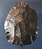 Discoid hand axe
 -
 Cordiform hand axe
 -
 Amygdaloid hand axe


In archaeology, a bout-coupé is a type of handaxe that constituted part of the Neanderthal Mousterian industry of the Middle Palaeolithic. The handaxes are bifacially-worked and in the shape of a rounded triangle. They are only found in Britain in the Marine Isotope Stage 3 (MIS 3) interglacial between 59,000 and 41,000 years BP, and are therefore considered a unique diagnostic variant.[89][90]
Lynford Quarry is the location of a well-preserved in-situ Middle Palaeolithic open-air site near Mundford, Norfolk.[91]
The site, which dates to approximately 60,000 years ago, is believed to show evidence of hunting by Neanderthals (Homo neanderthalensis). The finds include the in-situ remains of at least nine woolly mammoths (Mammuthus primigenius), associated with Mousterian stone tools and debitage. The artefactual, faunal and environmental evidence were sealed within a Middle Devensian palaeochannel with a dark organic fill. Well preserved in-situ sites of the time are exceedingly rare in Europe and very unusual within a British context.[92]
The site also produced rhinoceros teeth, antlers, as well as other faunal evidence. The stone tools on the site numbered 600, made up of individual artefacts or waste flakes. Particularly interesting were the 44 hand axes of sub-triangular or ovate form.[93]
The site was dated to Marine Isotope Stage 3 using Optically Stimulated Luminescence dating of the sand from the two layers of deposits within the channel.[93]
The Last Glacial Maximum is referred to in Britain as the Dimlington Stadial, dated to between 31,000 and 16,000 years.[94][95] In the archaeology of Paleolithic Europe, the LGM spans the Aurignacian, Gravettian, Solutrean, Magdalenian and Périgordian cultures.
Odderade interstadial[edit | edit source]
The Odderade interstadial has a 14C date of 61-72 kyr B.P. and corresponds to GIS 21.[81]
"During the Odderade interstadial, the limit of the south-boreal and the mixed forest may be situated at Watten, while the transition from the north-boreal to the middle-boreal forest is found in the Netherlands and northern Germany."[96]
Early Middle Weichselian[edit | edit source]
"The early Middle Weichselian is assumed to correspond to the period 80-62kyr BP and to MIS-4. During this interval, average sea levels reached lower values than during the Early Weichselian and ice extent can be expected to have been substantial. But, as the global sea-level oscillations in this interval are also large, substantial ice-volume fluctuations can be anticipated across northern Eurasia within this stage."[97]
Marine Isotope Stage 4[edit | edit source]

"Using stone tool residue analysis with supporting information from zooarchaeology, we provide evidence that at the Abri du Maras, Ardèche, France, Neanderthals [a skull is imaged on the left from Abri du Maras] were behaviorally flexible at the beginning of MIS 4. Here, Neanderthals exploited a wide range of resources including large mammals, fish, ducks, raptors, rabbits, mushrooms, plants, and wood. Twisted fibers on stone tools provide evidence of making string or cordage."[98]
MIS Boundary 4/5 is at 71 ka.[99]
Marine Isotope Stage 5[edit | edit source]
Marine Isotope Stage 5 or MIS 5 is a Marine Isotope Stage in the geologic temperature record, between 130,000 and 80,000 years ago.[100]
"The Neanderthal fossils [from Denisova cave] examined dated from 80,000 to 140,000 years ago. The dates indicate that the two hominin groups crossed paths at the cave and may have even been interbreeding during that time."[101]
Early Weichselian[edit | edit source]
"The Early Weichselian spans the interval from c. 118 kyr BP to c. 80 kyr BP and corresponds to the two stadials MIS-5d and 5b and the two interstadials MIS-5c and 5a."[97]
Rederstall Stadial[edit | edit source]
MIS Boundary 5.3 is at 96 ka.[99]
MIS Boundary 5.2 (peak) is at 87 ka.[99]
MIS Boundary 5.1 (peak) is at 82 ka.[99]
Both "the Brørup and Odderade interstadials [occur] near Watten (northern France)".[96]
Vegetation "maps for the Early Weichselian along the North Sea basin [...] show a vegetation gradient from the Scandinavian sites to the more temperate northern France."[96]
"By comparison with the profiles described from northern Germany by Menke and Tynni (1984) and Behre (1989), it is now possible, on stratigraphical grounds, to correlate the stadial phases observed at Watten with the Herning (pollen zone 2) and the Rederstall stadial (pollen zone 4) despite the fact that the floristic composition of the vegetation is not the same."[96]
Brørup interstadial[edit | edit source]

The "Brørup interstade [is about] 100 ka BP".[58] It corresponds to GIS 23/24.[81]
"A flint handaxe, recovered on a stretch of shore in St Ola, could be the oldest man-made artefact found in Orkney to date."[102]
"Around 14cm long, the Orkney axe was picked up by Evie man, Alan Price, who passed it to county archaeologist, Julie Gibson. The axe has been broken and originally would have tapered to a point opposite the cutting edge. But at some point in antiquity, the point broke off and someone reworked the flint to its present straight edge."[102]
“The problem with the Palaeolithic axes found in Scotland, to date, is that because they were not found ‘in context’ — that is, associated with other finds of the same era — there is some debate as to their authenticity. But we’re not going to find much contextual evidence, as we’re not likely to find sites of that date in Scotland that still have hearths and postholes still in situ.”[103]
“We have to remember that this was an incredibly long time ago — pre-Ice Age, in fact. Britain wasn’t an island but was still connected to mainland Europe, and across this landscape the people of the Palaeolithic, nomadic hunter-gatherers, wandered from season to season.”[103]
“What we can say is that it is definitely older than 100,000 years — so old it’s become geology. Palaeolithic people must have passed through what was later to become Scotland, so we’ve not discounted the possibility that the axe is evidence of people of that era in this area. But, because it’s so early, we need further information first."[103]
“A site visit, to check for the presence of other flint nodules, will be first on the agenda to see whether there is any more evidence of ballast in the area the axe was found, and we’re hoping to take first steps soon.”[103]
“This exciting and intriguing find raises more questions than it answers. It would be useful to know more about ballast deposition practice around Kirkwall Harbour, and we would be very interested in hearing from anyone who has information on local traditions."[104]
"The only other suspected Palaeolithic axe found in Orkney came from Upperborough, in Harray. This axe was discovered in the early years of the 20th century and presented to the National Museum of Antiquities of Scotland in 1913."[102]
It was “picked up . . . on the surface of the ground, in gravel, on the common to the west of the township of Upperborough, Harray, at about half a mile distant from the Loch of Harray, and some five miles from the sea”.[104]
The "Harray artefact was not from the Palaeolithic".[103]
"The Palaeolithic – or Old Stone Age – was a long period of hunter-gatherers, extending from the time when humans first evolved up to about 10,000 BC. In Britain, the earliest evidence of human activity dates from about 700,000 years ago, although there are long periods, of 100,000 years or more, when there appears to have been no human presence. The period is divided up by historians into the Lower (the oldest), Middle and Upper Palaeolithic to indicate when social and technological developments – mainly increasingly sophisticated flint tools – occurred."[102]
"The vegetation observed at Watten during the Brørup interstadial is a mixed forest of conifers and deciduous trees, while at the same time northwestern Europe is covered by a middle- and south-boreal forest."[96]
MIS Boundary 5.4 (peak) is at 109 ka.[99]
Herning Stadial[edit | edit source]
MIS Boundary 5.5 (peak) is at 123 ka.[99]
"By comparison with the profiles described from northern Germany by Menke and Tynni (1984) and Behre (1989), it is now possible, on stratigraphical grounds, to correlate the stadial phases observed at Watten with the Herning (pollen zone 2)".[96]
Eemian interglacial[edit | edit source]
The "controversially split Eemian period, the predecessor of our own warm period about 125,000 years ago."[18]
| Pollen zone | Species | Duration (kyr) | Initial chronology
Start (kyr BP) |
|
Modified chronology Start |
|
|---|---|---|---|---|---|---|
| E6b | Pinus | 2.5 | 122.0 | 119.5 | 122.0 | 119.54 |
| E6a | Picea | 2 | 124.5 | 122.0 | 124.0 | 122.0 |
| E5 | Carpinus | 3.5 | 129.5 | 124.5 | 128.0 | 124.5 |
| E4b | Taxus/Tilia | 1.1 | 130.6 | 129.5 | 129.1 | 128.0 |
| E4a | Corylus | 0.7 | 131.3 | 130.6 | 129.8 | 129.1 |
| E3b | Quercus, Corylus | 0.45 | 131.75 | 131.3 | 130.25 | 129.8 |
| E3a | Quercus | 0.25 | 132.0 | 131.75 | 130.50 | 130.25 |
| E2b | Pinus, Quercus | 0.2 | 132.2 | 132.0 | 130.70 | 130.5 |
| E2a | Pinus, Ulmus | 0.2 | 132.4 | 132.2 | 130.90 | 130.7 |
| E1 | Betula, Pinus | 0.1 | 132.5 | 132.4 | 131.0 | 130.9 |
Marine Isotope Stage 5e[edit | edit source]
"In the deep sea record the onset of the Last Interglacial and MIS-5e is usually defined as the time when global sea level was midway between its lowest value at the end of the glacial maximum at c. 140 kyr BP and the time at which present sea level was first reached at c. 130-129 kyr BP (Stirling et al. 1998), or at c. 135 kyr BP. This is not a precise definition, because the time at which the sea-level rise started is not well constrained and the rise may not have been uniform as is indicated by the oscillation that may have occurred during this rise (Esat et al. 1999). In northern Europe the definition of the Eemian period is based on the fossil pollen record, and the relative chronology defined by Müller (1974) and Zagwijn (1996) is adopted here ([above table]). The Eemian is characterized by a uniform vegetation development and similar pollen zones can be identified across the entire region from the Atlantic coast and North Sea to the Arkhangelsk region. In particular, for the early Eemian (the pollen zones E1-E4 of Zagwijn 1983, 1996), differences in arrival time of species across the region appear to have been small and the relative chronology is assumed to be the same across the region (Zagwijn 1996; Grichuk 1984; Eriksson 1993). Beginning with the Carpinus zone (zone E5) differences in the timing of the pollen zones across the region may have been greater, but because most of the evidence discussed here relates to the early period this is not significant for present purposes. Thus we adopt this relative chronology across northern Europe."[97]
"In the pollen diagrams, the interval E2a to E4b is a time when temperatures were higher than at any time during the remainder of the interglacial or at any time during the Holocene. This interval is also characterized by Baltic Sea salinities that were higher than at any other time in either the Eemian or Holocene (Funder et al. 2002). Evidence from The Netherlands (Zagwijn 1983, 1996; Beets & Beets 2003) and northwestern Germany (Caspers et al. 2002) indicates that the warmest conditions occurred shortly before the cessation of the rapid sea-level rise in this region and the usual practice has been to relate the end of E4b to the time of cessation of the global sea-level rise (Funder et al. 2002; Beets & Beets 2003). However, this association needs examination because of differential isostatic contributions among the North Sea and western Baltic locations and with respect to the sites used to establish the global sea-level function. Without knowledge of the Late Saalian ice sheet this lag cannot be evaluated, and in the first instance we adopt the same assumption and return to the relationship between the pollen and U/Th time scale once a satisfactory approximation of the ice model has been derived. Zagwijn (1996) defines the start of the Eemian as the pollen zone E1, c. 3000 years before the end of zone 4b ([above table]), and this places it at 132-133 kyr BP in the preliminary U/Th time scale (Funder et al. 2002). This is later than in the previous definition of c. 135 kyr BP for the start of MIS-5e, but for the present we adopt the time of onset of the pollen zone E1 at 132.5 kyr BP, implying that this occurred c. 2.5 kyr after the onset of the interglacial as defined by the mid-point between the end of the glacial maximum and the time at which present sea level was first reached. For European Russia and West Siberia we adopt the stratigraphic nomenclature and equivalences summarized by Larsen et al. (1999a) and we assume that the boreal period as far east as the Taymyr Peninsula has the same chronology as its northern European counterpart."[97]
"Sequence boundary Rf3 [...], which also has been termed INO3 (Norsk Hydro, 2003), is commonly observed as a smooth and featureless reflector within the data set. We note that in an area across the southern part of the Helland-Hansen Arch the reflector is showing an irregular appearance [...]. In MD99-2289 Rf3 appears to coincide with the identified MIS 5e level (Berstad, 2003), thus revealing a reflector age of about 120 ka."[71]
"The end of MIS-5e is defined as the time of onset of the global sea-level fall (c. 119-120 kyr BP) and the observed duration of interglacial sea levels near their present value (c. 10-11 kyr) compares well with the estimated duration of the pollen zones E5-E6b of Müller (1974) and with his inference that the interglacial ended with the end of the E6-b pollen zone. Thus, we fix the end of the pollen zone E6b at 119.5 kyr BP."[97]
"The Eem interglaciation […] lasted from 131 to 117 kyr B.P."[18]
Marine Isotope stage 6[edit | edit source]
"Rf2 is commonly observed as a high amplitude reflector within the seismic data. The reflector, which locally is segmented, is traced to IMAGES core MD99-2289 where it is identified at a core depth of about 20 m. The planktonic foraminiferal assemblage and stable isotope records indicate that the last interglacial period (Marine Isotope Stage (MIS) 5e) is located at a core depth of about 18.6 m (Berstad, 2003). Thus, as Rf2 is correlated to a level just below MIS 5e, we envisage MIS 6 as a minimum age for the reflector."[71]
"The most complete glaciation record is preserved in the North Sea Basin, where continuous subsidence created accommodation space for Pleistocene glacial and interglacial sediments (Stewart & Lonergan 2011). Since 2000, numerous seismic studies have been carried out in the North Sea area, providing evidence for seven glaciations during the Middle and Late Pleistocene (Huuse & Lykke-Andersen 2000; Sejrup et al. 2005; Lutz et al. 2009; Stewart & Lonergan 2011)."[105]
Marine Isotope Stage 7[edit | edit source]
"Optically stimulated luminescence age estimates for the Pleistocene beach at Morston, north Norfolk, UK, obtained by the single-aliquot regenerative-dose protocol, indicate a Marine Isotope Stage (MIS) 7–6 transition date. The view that the beach is of Ipswichian (MIS 5e) age, held virtually unanimously for the last 75 years, may now be discarded. The extant beach sequence lies up to ∼5 m OD, yet global models suggest that MIS 7–6 sea levels were typically substantially below that of today. The explanation may lie with poorly understood regional tectonic movements. The MIS 7–6 date helps to constrain the ages of glacial deposits that bracket the beach sediments at Morston. The underlying Marly Drift till cannot be younger than MIS 8; this may also be true for the complex assemblage of glaciogenic landforms and sediments, including the Blakeney esker, in the adjacent lower Glaven valley. The well-established Late Devensian (MIS 2) age of the Hunstanton Till is not compromised by the date of the Morston beach. There is no indication of a proposed Briton's Lane glaciation during MIS 6 times."[106]
"The potential for Middle Palaeolithic sites to survive beneath the sea in northern latitudes has been established by intensive investigation within Area 240, a marine aggregate licence area situated in the North Sea, 11km off the coast of Norfolk, England. The fortuitous discovery of bifacial handaxes, and Levallois flakes and cores, led to a major programme of fieldwork and analysis between 2008 and 2013. The artefacts were primarily recovered from Marine Isotope Stage 8/7 floodplain sediments deposited between 250 and 200 ka. It is considered that the hand axes and Levallois products are contemporaneous in geological terms with taphonomically complex sedimentary contexts, as observed in several north-west European sites. The Early Middle Palaeolithic (EMP) lithics have survived multiple phases of glaciation and marine transgression. The investigations confirm that the artefacts are not a ‘chance’ find, but indicate clear relationships to submerged and buried landscapes that, although complex, can be examined in detail using a variety of existing fieldwork and analytical methods. The palaeogeographical context of the finds also offers expanded interpretations of the distribution of EMP hominins in the southern North Sea, not predictable from onshore archaeological records."[107]
MIS Boundary 7/8 is at 243 ka.[99]
Marine Isotope Stage 8[edit | edit source]
"Observation of iceberg scourings, of MIS 8 age, about 800 m below the present day sea level, suggest that the south Vøring margin has subsided by a rate of 1.2 m/kyr in the Late Quaternary."[71]
"During MIS 8 and MIS 6, [there] may have been [...] two ice advances. Luminescence ages of glaciolacustrine delta deposits point to a deposition during MIS 8 or early MIS 6, and late MIS 6 (250±20 to 161±10 ka)."[105]
The Fuhne in Northern Germany corresponds with MIS 8.[105]
"In a few sites in the Netherlands, Denmark and Poland, glacigenic sediments occur that may indicate a glaciation during MIS 8. During this time, the North Sea Basin was most likely occupied by an extensive ice sheet (Beets et al. 2005; Hall & Migon ́ 2010; Houmark-Nielsen 2011; Laban & van der Meer 2011; Marks 2011; Kars et al. 2012). In contrast, infrared radiofluorescence ages of fluvial deposits in eastern Germany range from 306±23 to 149±8 ka, pointing to a long period without glaciations during MIS 9 to early MIS 6 (Krbetschek et al. 2008)."[105]
"Luminescence dating of the Freden delta complex gave MIS 8 to MIS 7 (250±20 to 241±27 ka) and MIS 7 to MIS 6 (196±19 to 161±10 ka) ages."[105]
Data "from the Netherlands and Denmark, where amino acid racemization and luminescence ages cluster at around ∼250 ka, thus pointing to an early Saalian glaciation during MIS 8 (Beets et al. 2005; Houmark-Nielsen 2011; Kars et al. 2012). High values of terrigenous input are also reported for MIS 8 and MIS 6 from the Bay of Biscay (Toucanne et al. 2009a, b). These two assumed Saalian ice advances may cor- relate with the deposition of the two different tills of the older Saalian Drenthe glaciation in northern Germany (cf. Litt et al. 2007; Stephan 2014)."[105]
MIS Boundary 8/9 is at 300 ka.[99]
Marine Isotope Stage 9[edit | edit source]
The base of the Pre-Illinoian stage has been correlated to the top of Marine Isotope Stage 9 at 300,000 BP.[99]
"A stalagmite from northern Norway is dated with 12 thermal ionization mass spectrometry U-Th dates, and at least four separate growth periods are identified that correspond with marine isotope stages 9, 11, 13, and probably 15. The calcite is tested for isotopic equilibrium with the Hendy test. Oxygen isotope measurements on 231 subsamples on a vertical transect are used as a paleotemperature proxy. The detailed isotopic record from MIS 9 show apparent similarities to a Holocene record from the same cave, both in the climatic evolution and the overall temperatures: both show temperature oscillations changing from high-frequency, low-amplitude cycles in the beginning of the interglacial period to lower frequency, higher amplitude cycles in the later part of the interglacial period. The isotope record from MIS 11 shows a distinct isotopic event toward heavier values. The isotopic record together with the porous, humus-rich calcite are interpreted as indicating a warmer than present interglacial period with several episodes of heavy rainfall."[108]
MIS Boundary 9/10 is at 337 ka.[99]
Marine Isotope Stage 10[edit | edit source]
Glaciations, "mainly indicated by the formation of tunnel valleys, are attrib- uted to ice advances during MIS 10, MIS 8, MIS 6, MIS 4 and MIS 2 (Stewart & Lonergan 2011)."[105]
"Data from Great Britain (Gibbard & Clark 2011; Lee etal. 2011), Denmark (Houmark-Nielsen 2011), the Netherlands (Laban & van der Meer 2011) and Poland (Marks 2011) indicate that the Elsterian glaciation occurred during MIS 12 [...], whereas data from northern Germany point to this glaciation taking place during MIS 10 (Geyh & Müller 2005; Litt et al. 2007)."[105]
"The number of MIS 12 and MIS 10 ice advances is somewhat unclear and varies from one in Poland and Great Britain (Gibbard & Clark 2011; Marks 2011), two in the North Sea area (Cohen & Gibbard 2010; Gibbard & Clark 2011; Houmark-Nielsen 2011; Marks 2011; Stewart & Lonergan 2011) to up to three in Denmark (Houmark-Nielsen 2011) and northern Germany (Caspers et al. 1995; Eissmann 2002; Litt et al. 2007; Ehlers et al. 2011; Stephan 2014)."[105]
"The luminescence dating results and analysis of the stratigraphical architecture of the Leine-valley fill point to repeated glaciations during the Middle Pleistocene (MIS 12, MIS 10, MIS 8 and MIS 6; [...])."[105]
"During the Elsterian glaciation, at least two ice advances occurred into the study area, based on luminescence ages of ice-marginal deposits, ranging from 461±34 to 421±25 ka (MIS 12) and from 376±27 to 337±21 ka (MIS 10)."[105]
"From the Bay of Biscay, a significant input of terrigenous material has been recorded during both MIS 12 and MIS 10, also pointing to two separate ice advances during the Elsterian glaciation (Toucanne et al. 2009a, b)."[105]
"The MIS 10 ice advance was associated with strong subglacial erosion, indicated by the formation of a ∼4.0–6.5 km wide, northeast−southwest trending erosional zone with several local overdeepenings [...]. The geometry and orientation of these overdeepenings were controlled by tectonic structures and lithological properties of the Mesozoic and Cenozoic bedrock [...]. These mini-basins are 25–60 m deep, up to 3.5 km long and up to 2.5 km wide and correspond in size to many other subglacial basins (e.g. Cook & Swift 2012). The deepest erosional features are developed above salt structures, where highly fractured rocks and an increased heat flow (cf. Grassmann et al. 2010) may have favoured bed coupling and plucking. Subglacial erosional processes partly included glaciotectonic thrusting, as indicated by displaced Cenozoic bedrock (Rohde 1983). During rapid ice-margin retreat, overdeepenings were filled with fine-grained glaciolacustrine deposits, partly rich in re-worked Tertiary lignite and amber (Fig. 8), which has also frequently been observed in late Elsterian tunnel valleys (Meyer 2009; Stephan 2014)."[105]
Marine Isotope Stage 11[edit | edit source]


Marine Isotope Stage 11 is a Marine Isotope Stage in the geologic temperature record, covering the interglacial period between 424,000 and 374,000 years ago.[99] It corresponds to the Hoxnian Stage in Britain.
The Hoxnian Stage was a middle Pleistocene stage of the geological history of the British Isles, an interglacial preceded the Wolstonian Stage and followed the Anglian Stage, equivalent to Marine Isotope Stage 11 (MIS 11).[109][110][111][112][113] The Hoxnian is divided into sub-stages Ho I to Ho IV.[114]
In Northwest Europe, the Hoxnian correlates with the Holsteinian.[105] It also correlates with the Ruhme in Northern Germany.[105]
MIS 11 represents the longest and warmest interglacial interval of the last 500 kyr: it shows the highest-amplitude deglacial warming in the last 5 Myr and possibly lasted twice the other interglacial stages, is characterized by overall warm sea-surface temperatures in high latitudes, strong thermohaline circulation, unusual blooms of calcareous plankton in high latitudes, higher sea level than the present, coral reef expansion resulting in enlarged accumulation of neritic carbonates, and overall poor pelagic carbonate preservation and strong dissolution in certain areas, and is considered the warmest interglacial period of the last 500,000 years.[115]
Carbon dioxide concentration during MIS 11 was possibly similar to that documented in the pre-industrial period, but not especially high when compared to other interglacial periods (for example, CO
2 concentration was probably higher during MIS 9).[116]
Sedimentary deposits from Greenland suggest a near-complete deglaciation of south Greenland, and a subsequent sea level rise of 4.5 to 6 metres of sea-level-equivalent volume during MIS 11, around 410,000 to 400,000 years ago.[117]
In contrast to most other interglacials of the late Quaternary, MIS 11 cannot be straightforwardly explained and modelled solely within the context of Milankovitch forcing mechanisms.[118]
MIS Boundary 11/12 is at 424 ka.[99]
Marine Isotope Stage 12[edit | edit source]
The Anglian Stage is the name used in the British Isles for a middle Pleistocene glaciation that precedes the Hoxnian Stage and follows the Cromerian Stage in the British Isles, correlates to Marine Isotope Stage 12 (MIS 12),[110][111][112] which started about 478,000 years ago and ended about 424,000 years ago.[99][113]
The Anglian stage has often been correlated to the Elsterian Stage of northern Continental Europe and the Mindel Stage in the Alps; however, there is ambiguity regarding the correlation of these two glacials to either MIS 12 or MIS 10, as described in more detail in the article 'Elster glaciation'.[119]
The Anglian was the most extreme glaciation during the last 2 million years, where in Britain the ice sheet reached the Isles of Scilly and the Western Approaches, the furthest south the ice reached in any Pleistocene ice age.[120] In the south-east of England it diverted the River Thames from its old course through the Vale of St Albans south to its present position.[121]
This stage had been equated to the Kansan Stage in North America; however, the terms Kansan Stage, along with Yarmouth, Nebraskan, and Aftonian stages, have been abandoned by North American Quaternary geologists and merged into the Pre-Illinoian stage.[122][123] The Anglian Stage is now correlated with the period of time which includes the Pre-Illinoian B glaciation of North America.[112][123]
Marine Isotope Stage 13[edit | edit source]
Marine Isotope Stage 13 in Britain covering the Cromerian interglacial period between ~524,000 and 474,000 years ago, split into three substages, MIS 13a MIS 13b, and MIS 13c, where some records indicate that MIS 13a was an unstable warm peak with a cold split in the middle at MIS 13.12 - separating warm MIS 13.11 and 13.13.[124] This interglacial follows the relatively warm glacial period associated with Marine Isotope Stage 14,[125] and is followed by the relatively cold glacial period associated with MIS 12.
MIS Boundary 13/14 is at 533 ka.[99]
"The deposits of the Bytham River, that flowed across central England until the Anglian glaciation (Marine Isotope Stage 12) overrode and destroyed it, have been exposed in many places, mostly in the context of gravel extraction, from Waverley Wood near Coventry in the west to Pakefield near Lowestoft on the East Anglian coast. Many of these sites have yielded artefacts. The present paper concentrates on large, detailed samples from Waverley Wood, Feltwell and Warren Hill collected by the late R.J. MacRae and the late Terry Hardaker. These samples draw attention to the fact that during Marine Isotope Stage 13 or earlier, an extensive Lower Palaeolithic population was spread across middle England and those inhabitants made use of whatever raw materials were available on site. The sites reported reflect localities where access to gravel extraction plants was permitted and a long-term watching brief could be maintained. The finds comprise mainly quartzite artefacts from Waverley Wood in the west, quartzite with some flint at Feltwell, and flint at Warren Hill in the east, and provide a perspective on how raw materials influenced artefact design within the region, prior to c. 450,000 yrs BP."[126]
Marine Isotope Stage 15[edit | edit source]
Deep sea core samples have identified approximately 5 glacial cycles of varying intensity during Gunz.[127][128]
The detailed stratigraphic table by the German Stratigraphic Commission puts the start of Gunz in the late Calabrian (approximately one million years ago, earlier than MIS 19) and shows a continuity of glacial cycles with the following Mindel stage, with the border arbitrarily put at the start of MIS 10 (approximately 374 000 years ago). Gunz corresponds roughly to the Cromerian stage in the glacial history of Northern Europe.[127]
Deep sea core samples have identified approximately 10 marine isotope stages (at least MIS 21 to MIS 11) during Gunz.[127]
MIS Boundary 15/16 is at 621 ka.[99]
Marine Isotope Stage 16[edit | edit source]
The most intense glacials of Gunz (MIS 16 and MIS 12) reached similar extents to those of the more recent Riss glaciation and Wurm glaciation glacials.[129][130] These have not been easy to identify in the geological record of the Alps, but MIS 16 has been identified with the Don Glaciation of Eastern Europe.[131]
MIS 16 is a major glacial stage identified through measurements of oxygene isotopes in deep sea core samples (marine isotope stage) of Cromerian age, approximately 676-621 ka ago.[132] In terms of global ice volume, it ranks as one of the two most extreme glaciations of the Quaternary, on par with MIS 12.[133][68] However, in terms of sea water temperatures it is a much more modest glaciation, of similar climate intensity to the neighbouring Cromerian glaciations MIS 14 and MIS 18.[133] The atmospheric concentration of CO
2 was below 180 ppm for 3 ka during MIS 16, the lowest of the last eight glacial cycles.[68]
Don and MIS 16 are usually correlated to each other based on assumption that the most widespread evidence for glaciation in the Cromerian ought to be associated with the largest glaciation on the global scene; however, the time resolution of current age determinations is insufficient for a clear distinction between MIS 14, MIS 16 and MIS 18.[68][134][135]
It is unclear why the major glaciation of MIS 16 has left very little evidence in the geological records of Western Europe.[134]
MIS 16 is believed to correspond to Pre-Illinoian D in North America.[136]
Marine Isotope Stage 17[edit | edit source]
"Cromerian Complex, Dunwich Group, Cromer Forest-bed Formation, Freshwater members of the Cromer Forest-bed Formation of Lewis in Bowen (1999)".[72]
Neogene[edit | edit source]
"The North Sea was a semi-enclosed basin during the Neogene. The marine connection between the southern North Sea Basin and the Channel was prevented by the Weald-Artois ridge, while in the north an open marine connection with the Norwegian-Greenland Sea existed (Ziegler, 1990; Rasmussen et al., 2008; Rasmussen et al., 2010)."[137]
See also[edit | edit source]
- Antarctic continental shelves
- Mediterranean continental shelves
- North east American continental shelves
- North Sea continental shelves
- North west African continental shelves
- South east African continental shelves
- South east Asian continental shelves
- South west African continental shelves
- West European continental shelves
References[edit | edit source]
- ↑ 1.0 1.1 1.2 1.3 1.4 1.5 1.6 1.7 Laura Spinney (December 2012). "Searching for Doggerland". National Geographic Magazine: 6. http://waughfamily.ca/Ancient/Doggerland%20-%20National%20Geographic.pdf. Retrieved 2017-02-02.
- ↑ Clive Waddington (December 2012). "Searching for Doggerland". National Geographic Magazine: 6. http://waughfamily.ca/Ancient/Doggerland%20-%20National%20Geographic.pdf. Retrieved 2017-02-02.
- ↑ Sasha Naomi Bharier Leigh (2007). A STUDY OF THE DYNAMICS OF THE BRITISH ICE SHEET DURING MARINE ISOTOPE STAGES 2 AND 3, FOCUSING ON HEINRICH EVENTS 2 AND 4 AND THEIR RELATIONSHIP TO THE NORTH ATLANTIC GLACIOLOGICAL AND CLIMATOLOGICAL CONDITIONS. St Andrews, Scotland: University of St Andrews. pp. 219. https://research-repository.st-andrews.ac.uk/bitstream/handle/10023/525/Sasha%20Leigh%20MPhil%20thesis.pdf?sequence=1. Retrieved 2017-02-16.
- ↑ 4.00 4.01 4.02 4.03 4.04 4.05 4.06 4.07 4.08 4.09 4.10 4.11 4.12 4.13 4.14 4.15 4.16 4.17 4.18 4.19 4.20 4.21 4.22 4.23 4.24 4.25 4.26 4.27 4.28 4.29 4.30 4.31 J W Merritt; C A Auton; E R Connell; A M Hall; J D Peacock (2003). Cainozoic geology and landscape evolution of north-east Scotland, In: Memoir of the British Geological Survey. British Geological Survey. http://earthwise.bgs.ac.uk/index.php/Offshore_stratigraphical_record,_Quaternary,_Cainozoic_of_north-east_Scotland. Retrieved 2017-02-17.
- ↑ 5.0 5.1 5.2 5.3 5.4 5.5 5.6 Pavel Kabat, Jos Bazelmans, Jouke van Dijk, Peter M.J. Herman, Tim van Oijen, Morten Pejrup, Karsten Reise, Hessel Speelman, Wim J. Wolff (15 June 2012). "The Wadden Sea Region: Towards a science for sustainable development". Ocean & Coastal Management 68: 4-17. doi:10.1016/j.ocecoaman.2012.05.022. https://epic.awi.de/id/eprint/31751/1/OCMA-WS-science2012.pdf. Retrieved 6 July 2021.
- ↑ Goffart, Walter (2003). Historical Atlases: The First Three Hundred Years, 1570-1870. University of Chicago Press. p. 126. ISBN 9780226300719. https://books.google.com/books?id=Qex4Pl0YATwC&pg=PA126&lpg=PA126. Retrieved 2018-09-16.
- ↑ Suess, Edward (1906). The Face of the Earth. Clarendon Press. p. 417. https://archive.org/details/faceearthdasant00suesgoog. Retrieved 2018-09-16. "dollart ems flood 1277."
- ↑ ""Stormvloed 1509" - een Nederlands – Duits cultuurhistorisch project" ["Stormvloed 1509" - a Dutch-German cultural-historical project]. Stichting Verdronken Geschiedenis (in Dutch). 2009. Retrieved 2018-09-16.
- ↑ Heligoland: Germany's hidden gem in the North Sea, The Guardian, 24 April 2011
- ↑ Ritsema, Alex (2007). Heligoland, Past and Present. Lulu Press. pp. 21–3. ISBN 978-1-84753-190-2.
- ↑ "Nautical chart "Helgoland"". Europäisches Segel-Informationssystem. Retrieved 27 July 2008.
{{cite web}}:|archive-date=requires|archive-url=(help) - ↑ "Helgoländer stimmen gegen Inselvergrößerung". Kieler Nachrichten (in German). 26 June 2011. Retrieved 27 June 2011.
{{cite news}}:|archive-date=requires|archive-url=(help) - ↑ 13.0 13.1 13.2 13.3 13.4 13.5 13.6 H.C. Hass (August 6-14, 2008). The sedimentary evolution of a mud depocenter in the southern North Sea since the Medieval Warm Period. Oslo, Norway: 33rd International Geological Congress.
- ↑ C.Michael Hogan. 2011. Wadden Sea. eds. P.Saundry & C.Cleveland. Encyclopedia of Earth. National Council for Science and the Environment. Washington DC
- ↑ 15.00 15.01 15.02 15.03 15.04 15.05 15.06 15.07 15.08 15.09 15.10 15.11 15.12 15.13 15.14 15.15 15.16 15.17 15.18 15.19 15.20 15.21 15.22 15.23 N. Schrøder; L. Højlund Pedersen; R. Juel Bitsch (2004). "10,000 Years of Climate Change and Human Impact on the Environment in the Area Surrounding Lejre". The Journal of Transdisciplinary Environmental Studies 3 (1): 1-27. http://www.journal-tes.dk/vol%203%20no%201/Niels%20Schroeder_lav.pdf?id=00019. Retrieved 2017-02-11.
- ↑ Y. T. van Popta, K. M. Cohen, P. C. Vos and Th. Spek (13 Dec 2020). "Reconstructing medieval eroded landscapes of the north-eastern Zuyder Zee (the Netherlands): a refined palaeogeographical time series of the Noordoostpolder between a.d. 1100 and 1400". Landscape History 41 (2): 27-56. doi:10.1080/01433768.2020.1835180. https://www.tandfonline.com/doi/pdf/10.1080/01433768.2020.1835180. Retrieved 5 July 2021.
- ↑ Scipius (16 March 2003). Heligoland. San Francisco, California: Wikimedia Foundation, Inc. https://en.wikipedia.org/wiki/Heligoland. Retrieved 2017-02-03.
- ↑ 18.0 18.1 18.2 18.3 18.4 Willi Dansgaard (2005). The Department of Geophysics of The Niels Bohr Institute for Astronomy Physics and Geophysics at The University of Copenhagen Denmark. ed. Frozen Annals Greenland Ice Cap Research. Copenhagen, Denmark: Niels Bohr Institute. pp. 123. ISBN 87-990078-0-0. http://www.iceandclimate.nbi.ku.dk/publications/FrozenAnnals.pdf/. Retrieved 2014-10-05.
- ↑ 19.0 19.1 Gifford H Miller; Aslaug Geirsdottir; Yafang Zhong; Darren J Larsen; Bette L Otto-Bliesner; Marika M Holland; David Anthony Bailey; Kurt A. Refsnider et al. (January 2012). "Abrupt onset of the Little Ice Age triggered by volcanism and sustained by sea-ice/ocean feedbacks". Geophysical Research Letters 39 (2): L02708. doi:10.1029/2011GL050168. http://adsabs.harvard.edu/abs/2012GeoRL..39.2708M. Retrieved 2014-10-09.
- ↑ Gunnar Heinsohn (8 September 2014). A Carbon-14 Chronology. Wordpress.com: Malaga Bay. http://malagabay.wordpress.com/2014/09/08/a-carbon-14-chronology/. Retrieved 2014-10-25.
- ↑ Gordon W. Pearson; Florence Qua (1993). "High-Precision 14C Measurement of Irish Oaks to Show the Natural 14C Variations from AD 1840-5000 BC: A Correction". Radiocarbon 35 (1): -24. https://journals.uair.arizona.edu/index.php/radiocarbon/article/viewFile/18069/17799#page=110. Retrieved 2014-10-25.
- ↑ 22.0 22.1 22.2 Hans-Ulrich Niemitz (3 April 2000). Did the Early Middle Ages Really Exist?. Cambridge, UK: Cambridge University. http://www.cl.cam.ac.uk/~mgk25/volatile/Niemitz-1997.pdf. Retrieved 2014-10-26.
- ↑ Keigwin, L. D. (1996). "The Little Ice Age and Medieval Warm Period in the Sargasso Sea". Science 274 (5292): 1504–1508. doi:10.1126/science.274.5292.1504. PMID 8929406. https://semanticscholar.org/paper/1f6691df237f3b357a2e7f9869da7280097760b8.
- ↑ Hiller, A.; Boettger, T.; Kremenetski, C. (2001). "Medieval climatic warming recorded by radiocarbon dated alpine tree-line shift on the Kola Peninsula, Russia". The Holocene 11 (4): 491–497. doi:10.1191/095968301678302931.
- ↑ 25.0 25.1 25.2 Peter C. Vos and Wesse P. van Kesteren (10 September 2000). "The long-term evolution of intertidal mudflats in the northern Netherlands during the Holocene; natural and anthropogenic processes". Continental Shelf Research 20 (12-13): 1687-1710. doi:10.1016/S0278-4343(00)00043-1. https://www.sciencedirect.com/science/article/abs/pii/S0278434300000431. Retrieved 6 July 2021.
- ↑ Mommsen, Theodore Ernst (1942). "Petrarch's Conception of the 'Dark Ages'". Speculum (Cambridge MA: Medieval Academy of America) 17 (2): 226–227. doi:10.2307/2856364.
- ↑ Berglund, B. E. (2003). "Human impact and climate changes—synchronous events and a causal link?". Quaternary International 105 (1): 7–12. doi:10.1016/S1040-6182(02)00144-1. http://www.geol.lu.se/personal/bnb/pdf-papers/human_impact.pdf.
- ↑ Curry, Andrew, "Fall of Rome Recorded in Trees", ScienceNOW, 13 January 2011.
- ↑ B. Yule (September 1990). The 'dark earth' and Late Roman London, In: Antiquity: A Review of World Archaeology. Quantavolution Magazine. http://www.q-mag.org/arthur-of-camelot-and-aththe-of-camulodunum.html. Retrieved 2017-06-21.
- ↑ J. Schofield (May 1990). Saxon London in a tale of two cities. http://www.q-mag.org/arthur-of-camelot-and-aththe-of-camulodunum.html. Retrieved 2017-06-21.
- ↑ Cambell, Ian D; Campbell, Celina; Apps, Michael J; Rutter, Nathaniel W; Bush, Andrew BG (1998). "Late Holocene similar to 1500yr climatic periodicities and their implications". Geology 26: 471–473. doi:10.1130/0091-7613(1998)026<0471:LHYCPA>2.3.CO;2.
- ↑ Mangerud, J. et al. (1974). "Quaternary stratigraphy of Norden, a proposal for terminology and classification". Boreas 3 (3): 109–128. doi:10.1111/j.1502-3885.1974.tb00669.x.
- ↑ 33.0 33.1 A. Speranza; J. van der Plicht; B. van Geel (November 2000). "Improving the time control of the Subboreal/Subatlantic transition in a Czech peat sequence by 14C wiggle-matching". Quaternary Science Reviews 19 (16): 1589-1604. doi:10.1016/S0277-3791(99)00108-0. http://www.researchgate.net/publication/30494985_Improving_the_time_control_of_the_SubborealSubatlantic_transition_in_a_Czech_peat_sequence_by_14C_wiggle-matching/file/60b7d51c350cf2efa0.pdf. Retrieved 2014-11-04.
- ↑ Franke, D. (2010). Regionale Geologie von Ostdeutschland – Ein Wörterbuch.
- ↑ Dahl, S. O.; Nesje, A. (1996). "A new approach to calculating Holocene winter precipitation by combining glacier equilibrium-line altitudes and pine-tree limits: a case study from Hardangerjøkulen, central southern Norway". The Holocene 6 (4): 381–398. doi:10.1177/095968369600600401.
- ↑ Broecker, W. S. (2001). "Was the Medieval Warm Period global?". Science 291 (5508): 1497–1499. doi:10.1126/science.291.5508.1497. PMID 11234078. https://semanticscholar.org/paper/8a4ed1e0237746c962a34629c4552c729e0b2ebe.
- ↑ Bond, G.; Kromer, Bernd; Beer, Juerg; Muscheler, Raimund; Evans, Michael N.; Showers, William; Hoffmann, Sharon; Lotti-Bond, Rusty et al. (2001). "Persistent Solar Influence on North Atlantic Climate During the Holocene". Science 294 (5594): 2130–2136. doi:10.1126/science.1065680. PMID 11739949. https://semanticscholar.org/paper/fc5ecd54a07f558dafdcab21bbe057de131c9667.
- ↑ Haselgrove, C. and Pope, R. (2007), 'Characterising the Earlier Iron Age', in C. Haselgrove and R. Pope (eds.), The Earlier Iron Age in Britain and the Near Continent. (Oxbow, Oxford)
- ↑ Marwick, Hugh (1947) The Place-names of Rousay.
- ↑ 40.0 40.1 E.B. Karabanov; A.A. Prokopenko; D.F. Williams; G.K. Khursevich (March 2000). "A new record of Holocene climate change from the bottom sediments of Lake Baikal". Palaeogeography, Palaeoclimatology, Palaeoecology 156 (3-4): 211–24. doi:10.1016/S0031-0182(99)00141-8. http://www.sciencedirect.com/science/article/pii/S0031018299001418. Retrieved 2014-11-04.
- ↑ 41.0 41.1 41.2 41.3 41.4 Sigurd Towrie (2004). The Ring of Brodgar, Stenness. OrkneyJar. http://www.orkneyjar.com/history/brodgar/. Retrieved 2017-02-04.
- ↑ 42.00 42.01 42.02 42.03 42.04 42.05 42.06 42.07 42.08 42.09 42.10 42.11 42.12 42.13 42.14 42.15 42.16 M.A. Kul'kova; A.N. Mazurkevich; P.M. Dolukhanov (2001). "Chronology and Palaeoclimate of Prehistoric Sites in Western Dvina-Lovat' Area of North-western Russia". Geochronometria 20: 87–94. http://www.geochronometria.pl/pdf/geo_20/geo_20_14.pdf. Retrieved 2017-02-11.
- ↑ Bryson 2010
- ↑ "Skara Brae: The Discovery of the Village". Orkneyjar. Retrieved 29 September 2012.
- ↑ 45.0 45.1 45.2 Axel Bojanowski; Translated and adapted from the German by Anne-Marie de Grazia (13 January 2015). Moss betrays the season of the Störegga event. Der Spiegel. http://www.q-mag.org/moss-betrays-the-season-of-the-storegga-event.html. Retrieved 2017-02-12.
- ↑ Knut Rydgren; Stein Bondevik (13 January 2015). Moss betrays the season of the Störegga event. Der Spiegel. http://www.q-mag.org/moss-betrays-the-season-of-the-storegga-event.html. Retrieved 2017-02-12.
- ↑ 47.0 47.1 Anne-Marie (Ami) de Grazia (February 2017). Lost forest of Doggerland found by divers under the North Sea. Daily Mail and Anne-Marie (Ami) de Grazia. http://www.q-mag.org/lost-forest-of-doggerland-found-by-divers-under-the-north-sea.html. Retrieved 2017-02-09.
- ↑ 48.0 48.1 48.2 Dawn Watson (February 2017). Lost forest of Doggerland found by divers under the North Sea. Daily Mail and Anne-Marie (Ami) de Grazia. http://www.q-mag.org/lost-forest-of-doggerland-found-by-divers-under-the-north-sea.html. Retrieved 2017-02-09.
- ↑ Rob Spray (February 2017). Lost forest of Doggerland found by divers under the North Sea. Daily Mail and Anne-Marie (Ami) de Grazia. http://www.q-mag.org/lost-forest-of-doggerland-found-by-divers-under-the-north-sea.html. Retrieved 2017-02-09.
- ↑ 50.0 50.1 Orkneyjar (3 November 2007). Hazelnut shell pushes back date of Orcadian site. StonePages. http://www.stonepages.com/news/archives/002600.html. Retrieved 2017-02-03.
- ↑ Caroline Wickham Jones (3 November 2007). Hazelnut shell pushes back date of Orcadian site. StonePages. http://www.stonepages.com/news/archives/002600.html. Retrieved 2017-02-03.
- ↑ 52.0 52.1 Sigurd Towrie (20 March 2008). New Contender for Orkney's Oldest settlement Site. Orkney College: OrkneyJar. http://www.orkneyjar.com/archaeology/2008/03/20/new-contender-for-orkneys-oldest-settlement-site/. Retrieved 2008-09-16.
- ↑ 53.0 53.1 53.2 53.3 Naomi Woodward (20 March 2008). New Contender for Orkney's Oldest settlement Site. Orkney College: OrkneyJar. http://www.orkneyjar.com/archaeology/2008/03/20/new-contender-for-orkneys-oldest-settlement-site/. Retrieved 2008-09-16.
- ↑ 54.00 54.01 54.02 54.03 54.04 54.05 54.06 54.07 54.08 54.09 54.10 54.11 54.12 54.13 Jean Deruelle; Anne-Marie de Grazia; translation; adaptation (2017). The "Great Plain" of Atlantis - was it in Doggerland?. Q-Magazine. http://www.q-mag.org/the-great-plain-of-atlantis-was-it-in-doggerland.html. Retrieved 2017-02-12.
- ↑ R. Muscheler; B. Kromer; S. Björck; A. Svensson; M. Friedrich; K. F. Kaiser; J. Southon (2008). "Tree rings and ice cores reveal 14C calibration uncertainties during the Younger Dryas". Nature Geoscience 1 (4): 263-7. doi:10.1038/ngeo128. http://www.nature.com/ngeo/journal/v1/n4/full/ngeo128.html. Retrieved 2014-10-09.
- ↑ 56.0 56.1 56.2 56.3 56.4 Jan Mangerud (1987). W. H. Berger and L. D. Labeyrie. ed. The Alleröd/Younger Dryas Boundary, In: Abrupt Climatic Change. D. Reidel Publishing Company. pp. 163-71. http://folk.uib.no/ngljm/PDF_files/Mangerud%201987,YD%20boundary.PDF. Retrieved 2014-11-03.
- ↑ 57.0 57.1 Scott J. Lehman; Lloyd D. Keigwin (30 April 1992). "Sudden changes in North Atlantic circulation during the last deglaciation". Nature 356: 757-62. http://www.whoi.edu/science/GG/paleoseminar/pdf/lehman92.pdf. Retrieved 2014-11-04.
- ↑ 58.0 58.1 58.2 58.3 58.4 58.5 58.6 Michael Houmark-Nielsen, (30 November 1994). "Late Pleistocene stratigraphy, glaciation chronology and Middle Weichselian environmental history from Klintholm, Møn, Denmark". Bulletin of the Geological Society of Denmark 41 (2): 181-202. http://2dgf.dk/xpdf/bull41-02-181-202.pdf. Retrieved 2014-11-03.
- ↑ R. B. Firestone; A. West; J. P. Kennett; L. Becker; T. E. Bunch; Z. S. Revay; P. H. Schultz; T. Belgya et al. (October 9, 2007). "Evidence for an extraterrestrial impact 12,900 years ago that contributed to the megafaunal extinctions and the Younger Dryas cooling". Proceedings of the National Academy of Sciences USA 104 (41): 16016-16021. doi:10.1073/pnas.0706977104. https://www.pnas.org/content/104/41/16016.full. Retrieved 22 April 2019.
- ↑ Kaiser, K., I. Clausen (2005) Palaeopedology and stratigraphy of the Late Palaeolithic Alt Duvenstedt site, Schleswig-Holstein (Northwest Germany). Archäologisches Korrespondenzblatt. vol. 35, pp. 1-20.
- ↑ Kaiser, K., A. Barthelmes, S.C. Pap, A. Hilgers, W. Janke, P. Kühn, and M. Theuerkauf (2006) A Lateglacial palaeosol cover in the Altdarss area, southern Baltic Sea coast (northeast Germany): investigations on pedology, geochronology and botany. Netherlands Journal of Geosciences. vol. 85, no. 3, pp. 197-220.
- ↑ Vandenberghe, D., C. Kasse, S.M. Hossain, F. De Corte, P. Van den Haute, M. Fuchs, and A.S. Murray (2004) Exploring the method of optical dating and comparison of optical and 14C ages of Late Weichselian coversands in the southern Netherlands. Journal of Quaternary Science. vol. 19, pp. 73-86.
- ↑ Kloosterman, J.B. (2007) Correlation of the Late Pleistocene Usselo Horizon (Europe) and the Clovis Layer (North America). American Geophysical Union, Spring Meeting 2007, abstract no. PP43A-02
- ↑ van Hoesel, A., W.Z. Hoek, F. Braadbaart, J. van der Plicht, G.M. Pennock, and M.R. Drury (2012) Nanodiamonds and wildfire evidence in the Usselo horizon postdate the AllerødeYounger Dryas boundary. Proceedings of the National Academy of Sciences of the United States. vol. 109, no. 20, article 7648e7653.
- ↑ van Hoesel, A., W.Z. Hoek, J. van der Plicht, G.M. Pennock, and M.R. Drury (2013) Cosmic impact or natural fires at the AllerødeYounger Dryas boundary: a matter of dating and calibration. Proceedings of the National Academy of Sciences of the United States. vol. 110, no. 41, article E3896.
- ↑ van Hoesel, A., W.Z. Hoek, G.M. Pennock, and M.R. Drury (2014) The Younger Dryas impact hypothesis: a critical review. Quaternary Science Reviews. vol. 83, pp. 95–114.
- ↑ Angelika Frantz, translated by Anne-Marie de Grazia (16 June 2013). A Stone Ax from Doggerland, In: Der Spiegel. http://www.q-mag.org/a-stone-ax-from-doggerland.html. Retrieved 2017-02-07.
- ↑ 68.0 68.1 68.2 68.3 Konrad A. Hughes; Jonathan T. Overpeck; Larry C. Peterson; Susan Trumbore (7 March 1996). Rapid climate changes in the tropical Atlantic region during the last deglaciation. 380. pp. 51-4. http://www.diagonalarida.cl/SemV/Hughen_etal_1996_tropicalAtlantic.pdf. Retrieved 2014-11-05.
- ↑ V. N. Livina; F. Kwasniok; T. M. Lenton (2009). "Potential analysis reveals changing number of climate states during the last 60 kyr". Climate of the Past (European Geosciences Union) 5: 2223–2237. doi:10.5194/cpd-5-2223-2009. http://www.clim-past.net/6/77/2010/cp-6-77-2010.pdf.
- ↑ "International Stratigraphic Chart". International Commission on Stratigraphy. 2010. Retrieved 24 February 2012.
- ↑ 71.0 71.1 71.2 71.3 71.4 71.5 Berit Oline Hjelstuen, Hans Petter Sejrup, Haflidi Haflidason, Atle Nygård, Ida M. Berstad, Gregor Knorr (September 2004). "Late Quaternary seismic stratigraphy and geological development of the south Vøring margin, Norwegian Sea". Quaternary Science Reviews 23 (16-17): 1847-1865. doi:10.1016/j.quascirev.2004.03.005. https://mi-pub.cen.uni-hamburg.de/fileadmin/files/forschung/theomet/docs/pdf/QuaterSci04.pdf. Retrieved 7 July 2021.
- ↑ 72.0 72.1 72.2 Andrew A McMillan, Richard J O Hamblin and Jon W Merritt (2005). An overview of the lithostratigraphical framework for the Quaternary and Neogene deposits of Great Britain (onshore), In: British Geological Survey Research Report. RR0404. pp. 38. http://nora.nerc.ac.uk/id/eprint/3241/1/RR04004.pdf. Retrieved 8 July 2021.
- ↑ 73.0 73.1 Yucheng Lin, Fiona D. Hibbert, Pippa L. Whitehouse, Sarah A. Woodroffe, Anthony Purcell, Ian Shennan & Sarah L. Bradley (1 April 2021). "A reconciled solution of Meltwater Pulse 1A sources using sea-level fingerprinting". Nature Communications 12: 2015. doi:10.1038/s41467-021-21990-y. https://www.nature.com/articles/s41467-021-21990-y. Retrieved 9 June 2021.
- ↑ Zicheng Yu; Ulrich Eicher (2001). "Three Amphi-Atlantic Century-Scale Cold Events during the Bølling-Allerød Warm Period". Géographie physique et Quaternaire 55 (2): 171-9. doi:10.7202/008301ar. http://www.lehigh.edu/~ziy2/pubs/YuGpQPreprint.pdf. Retrieved 2014-11-04.
- ↑ 75.0 75.1 75.2 75.3 Tim Hornyak (2 June 2021). "An Ancient Meltwater Pulse Raised Sea Levels by 18 Meters". Eos. Eos. doi:10.1029/2021EO159031. Retrieved 9 June 2021.
- ↑ 76.0 76.1 Yucheng Lin (2 June 2021). "An Ancient Meltwater Pulse Raised Sea Levels by 18 Meters". Eos. Eos. doi:10.1029/2021EO159031. Retrieved 9 June 2021.
- ↑ 77.0 77.1 Yusuke Yokoyama (2 June 2021). "An Ancient Meltwater Pulse Raised Sea Levels by 18 Meters". Eos. Eos. doi:10.1029/2021EO159031. Retrieved 9 June 2021.
- ↑ 78.0 78.1 Pippa Whitehouse (2 June 2021). "An Ancient Meltwater Pulse Raised Sea Levels by 18 Meters". Eos. Eos. doi:10.1029/2021EO159031. Retrieved 9 June 2021.
- ↑ Richard G. Fairbanks (7 December 1989). "A 17,000-year glacio-eustatic sea level record: influence of glacial melting rates on the Younger Dryas event and deep-ocean circulation". Nature 342: 637-642. doi:10.1038/342637a0. https://www.nature.com/articles/342637a0. Retrieved 9 June 2021.
- ↑ 80.0 80.1 80.2 80.3 80.4 80.5 80.6 Sarah Griffiths (8 December 2014). Mammoth skeleton hauled from the North Sea's depths: Bones shed light on how beasts roamed icy tundra between Britain and mainland Europe 40,000 years ago. DailyMail. http://www.dailymail.co.uk/sciencetech/article-2865374/Mammoth-skeleton-hauled-North-Sea-s-depths-Bones-shed-light-beasts-roamed-tundra-Britain-mainland-Europe-40-000-years-ago.html. Retrieved 2017-02-14.
- ↑ 81.0 81.1 81.2 Barbara Wohlfarth (April 2010). "Ice-free conditions in Sweden during Marine Oxygen Isotope Stage 3?". Boreas 39: 377-98. doi:10.1111/j.1502-3885.2009.00137.x. http://people.su.se/~wohlf/pdf/Wohlfarth%20Boreas%202010.pdf. Retrieved 2014-11-06.
- ↑ A.K. Markova et al. (2015). "Changes in the Eurasian distribution of the musk ox (Ovibos moschatus) and the extinct bison (Bison priscus) during the last 50 ka BP". Quaternary International. doi:10.1016/j.quaint.2015.01.02.
- ↑ The Holocene distribution of European bison - the archaeozoological record. Norbert Benecke. Munibe (Antropologia_Arkeologia) 57 421-428 2005. ISSN=1132-2217. Refers to Liljegren R. and Ekstrom J., 1996. The terrestrial late Glacial fauna in south Sweden. In L. Larsson (Hrsg). The earliest settlement of Scandinavia and its relationship with neighbouring areas. Acta Archaeologica Lundensia 8, 24, 135-139, Stockholm.
- ↑ 84.0 84.1 84.2 84.3 Eiliv Larsen; Steinar Gullicksen; Stein-Erik Lauritzen; Rolf Lie; Reidar Løvlie; Jan Mangerud (1 September 1987). "Cave stratigraphy in western Norway; multiple Weichselian glaciations and interstadial vertebrate fauna". Boreas 16: 267-292. https://folk.uib.no/ngljm/PDF_files/Larsen%20et%20al%201987,%20cave%20strat.%20W-Norway.PDF. Retrieved 25 January 2020.
- ↑ J. Vandenberghe; G. Nugteren (2001). "Rapid climatic changes recorded in loess successions". Global and Planetary Change 28 (1-9): 222-30. http://shixi.bnu.edu.cn/field-trips/cooperation/ChinaSweden/the%20link/1.1.4.pdf. Retrieved 2014-11-06.
- ↑ A.A. Nikonov; M.M. Shakhnovich; J. van der Plicht (2011). "Age of Mammoth Remains from the Submoraine Sediments of the Kola Peninsula and Karelia". Doklady Earth Sciences 436 (2): 308-10. http://cio.eldoc.ub.rug.nl/FILES/root/2011/DoklEarthSciNikonov/2011DoklEarthSciNikonov.pdf?origin=publication_detail. Retrieved 2014-11-06.
- ↑ Geocollect (8 May 2016). With no words. WordPress. https://geocollect.wordpress.com/tag/north-sea/. Retrieved 2017-02-07.
- ↑ Markus Broch (8 December 2014). Mammoth skeleton hauled from the North Sea's depths: Bones shed light on how beasts roamed icy tundra between Britain and mainland Europe 40,000 years ago. DailyMail. http://www.dailymail.co.uk/sciencetech/article-2865374/Mammoth-skeleton-hauled-North-Sea-s-depths-Bones-shed-light-beasts-roamed-tundra-Britain-mainland-Europe-40-000-years-ago.html. Retrieved 2017-02-14.
- ↑ Pettitt, Paul; White, Mark (2012). The British Palaeolithic: Human Societies at the Edge of the Pleistocene World. Abingdon, UK: Routledge. p. 349. ISBN 978-0-415-67455-3.
- ↑ White, Mark J; Jacobi, Roger M (May 2002). "Two Sides to Every Story: Bout Coupé Handaxes Revisited". Oxford Journal of Archaeology (Wiley Online Library) 21 (2): 109–133. doi:10.1111/1468-0092.00152. http://onlinelibrary.wiley.com/doi/10.1111/1468-0092.00152/abstract.
- ↑ Lynford Quarry, Mundford, Norfolk. English Heritage. 30 May 2003. http://webarchive.nationalarchives.gov.uk/20060214231123/http://www.english-heritage.org.uk/server/show/conWebDoc.3892. Retrieved 17 August 2014.
- ↑ Donoghue, J (2006). "The Lynford mammoths: slaughtered by Neanderthals?". Current Archaeology (205): 40-44.
- ↑ 93.0 93.1 Boismier, B. (2002). "Lynford Quarry, A Neanderthal butchery site". Current Archaeology 16 (182): 53-58.
- ↑ Ashton, Nick (2017). Early Humans. William Collins. p. 241. ISBN 978-0-00-815035-8.
- ↑ "Radiocarbon dates from the site at Dimlington led Rose (1985) to designate this area as the UK type site for the Late Devensian Chronozone or 'Dimlington' Stadial." Boston, Clare M. (2007) An examination of the Geochemical properties of late devensian glacigenic sediments in Eastern England, Durham theses, Durham E-Theses Online: etheses.dur.ac.uk/2609
- ↑ 96.0 96.1 96.2 96.3 96.4 96.5 Anne-Françoise Emontspohl (April 1995). "The northwest European vegetation at the beginning of the Weichselian glacial (Brørup and Odderade interstadials)—new data for northern France". Review of Palaeobotany and Palynology 85 (3-4): 231-242. doi:10.1016/0034-6667(94)00128-7. https://www.sciencedirect.com/science/article/abs/pii/0034666794001287. Retrieved 4 July 2021.
- ↑ 97.0 97.1 97.2 97.3 97.4 97.5 Kurt Lambeck; Anthony Purcell; Svend Funder; Kurt H. Kjær; Eiliv Larsen; Per Möller (2006). "Constraints on the Late Saalian to early Middle Weichselian ice sheet of Eurasia from field data and rebound modelling". Boreas 35: 539-75. doi:10.1080/03009480600781875. https://www.academia.edu/17754299/Constraints_on_the_Late_Saalian_to_early_Middle_Weichselian_ice_sheet_of_Eurasia_from_field_data_and_rebound_modelling?auto=download. Retrieved 6 February 2020.
- ↑ Bruce L. Hardy; Marie-Hélène Moncel; Camille Daujeard; Paul Fernandes; Philippe Béarez; Emmanuel Desclaux; Maria Gem; Chacon Navarro et al. (15 December 2013). "Impossible Neanderthals? Making string, throwing projectiles and catching small game during Marine Isotope Stage 4 (Abri du Maras, France)". Quaternary Science Reviews 82 (12): 23-40. doi:10.1016/j.quascirev.2013.09.028. https://www.sciencedirect.com/science/article/pii/S0277379113003788. Retrieved 12 July 2018.
- ↑ 99.00 99.01 99.02 99.03 99.04 99.05 99.06 99.07 99.08 99.09 99.10 99.11 99.12 99.13 99.14 Lisiecki, L.E., 2005, Ages of MIS boundaries. LR04 Benthic Stack Boston University, Boston, MA
- ↑ Medley, S. Elizabeth (2011). High Resolution Climate Variability from Marine Isotope Stage 5: a Multi-Proxy Record from the Cariaco Basin, Venezuela. University of California. http://gradworks.umi.com/34/82/3482005.html.
- ↑ Carolyn Wilke (January 30, 2019). Denisovans and Neanderthals likely overlapped at this Stone Age hot spot for thousands of years, and modern Homo sapiens may have dwelled there, too.. The Scientist. https://www.the-scientist.com/news-opinion/researchers-home-in-on-when-different-hominins-shared-denisova-cave-65412. Retrieved 31 January 2019.
- ↑ 102.0 102.1 102.2 102.3 Sigurd Towrie (26 May 2011). DOES FLINT AXE PICKED UP ON AN ORKNEY SHORELINE PREDATE THE ICE AGE?. Orkney, Scotland: OrkneyJar. http://www.orkneyjar.com/archaeology/2011/05/26/flint-axe-found-on-orkney-shore-predates-the-ice-age/. Retrieved 2017-02-04.
- ↑ 103.0 103.1 103.2 103.3 103.4 Caroline Wickham-Jones (26 May 2011). DOES FLINT AXE PICKED UP ON AN ORKNEY SHORELINE PREDATE THE ICE AGE?. Orkney, Scotland: OrkneyJar. http://www.orkneyjar.com/archaeology/2011/05/26/flint-axe-found-on-orkney-shore-predates-the-ice-age/. Retrieved 2017-02-04.
- ↑ 104.0 104.1 Lynda Aiano (26 May 2011). DOES FLINT AXE PICKED UP ON AN ORKNEY SHORELINE PREDATE THE ICE AGE?. Orkney, Scotland: OrkneyJar. http://www.orkneyjar.com/archaeology/2011/05/26/flint-axe-found-on-orkney-shore-predates-the-ice-age/. Retrieved 2017-02-04.
- ↑ 105.00 105.01 105.02 105.03 105.04 105.05 105.06 105.07 105.08 105.09 105.10 105.11 105.12 105.13 105.14 Julia Roskosch, Jutta Winsemann, Ulrich Polom, Christian Brandes, Sumiko Tsukamoto, Axel Weitkamp, Werner A. Bartholomäus, Dierk Henningsen and Manfred Frechen (January 2015). "Luminescence dating of ice-marginal deposits in northern Germany: evidence for repeated glaciations during the Middle Pleistocene (MIS 12 to MIS 6)". Boreas 44: 103-126. doi:10.1111/bor.12083. https://www.academia.edu/27559452/Luminescence_dating_of_ice_marginal_deposits_in_northern_Germany_evidence_for_repeated_glaciations_during_the_Middle_Pleistocene_MIS_12_to_MIS_6_?auto=download&email_work_card=download-paper. Retrieved 11 July 2021.
- ↑ P. G. Hoare, S. J. Gale, R. A. J. Robinson, E. R. Connell, N. R. Larkin (16 April 2009). "Marine Isotope Stage 7–6 transition age for beach sediments at Morston, north Norfolk, UK: implications for Pleistocene chronology, stratigraphy and tectonics". Journal of Quaternary Science 24 (4): 311-316. doi:10.1002/jqs.1267. https://onlinelibrary.wiley.com/doi/abs/10.1002/jqs.1267. Retrieved 3 July 2021.
- ↑ Louise Tizzard, Andrew R. Bicket, Jonathan Benjamin, Dimitri De Loecker (10 October 2014). "A Middle Palaeolithic site in the southern North Sea: investigating the archaeology and palaeogeography of Area 240". Journal of Quaternary Science 29 (7): 698-710. doi:10.1002/jqs.2743. https://d1wqtxts1xzle7.cloudfront.net/48812506/Tizzard_etal_JQS_2014-with-cover-page-v2.pdf?Expires=1625380387&Signature=WL4x-NBykYr2rQ3wFvZ9Ezt-3BFU5ZpdD-TefAeUy2n4dIyEO1FLLswDEp167tth5iQy4NGjEmHf4PF8Q4bocQTbefKOa0fCBuuGtlR65DQHBbOQY1jU9SwOt4gqfJFJ9svfDCwJwIxZtLgZxx1~eUKJm7FqsL4xpLKluOVxwk8ROkjLVkM70bRDEaa5~46Jts2wiK-dhX2ZX4xbtDrXOJbzZIZJiJKkPFDSk4CaQnQR7nx8vSASQnDXhkkNga7pc795emO7wb1p4yAeYSqpKu0gJinLNF-aJDx~ztPmC5VMoYziApsvbg9SIj8wCxDXA~a97odKDl0EfL785AuRaw__&Key-Pair-Id=APKAJLOHF5GGSLRBV4ZA. Retrieved 3 July 2021.
- ↑ Ida M. Berstad, Joyce Lundberg, Stein-Erik Lauritzen and Henriette C. Linge (November 2002). "Comparison of the Climate during Marine Isotope Stage 9 and 11 Inferred from a Speleothem Isotope Record from Northern Norway". Quaternary Research 58 (3): 361-371. doi:10.1006/qres.2002.2387. https://www.cambridge.org/core/journals/quaternary-research/article/abs/comparison-of-the-climate-during-marine-isotope-stage-9-and-11-inferred-from-a-speleothem-isotope-record-from-northern-norway/9BFB0BAB664B5682968D3C8E285A0FB5. Retrieved 3 July 2021.
- ↑ Stringer, Chris (2006). Homo Britannicus: The incredible story of human life in Britain. London: Penguin. ISBN 978-0-14-101813-3. https://archive.org/details/homobritannicus00chri.
- ↑ 110.0 110.1 McMillan, A.A. (2005). "A provisional Quaternary and Neogene lithostratigraphic framework Great Britain". Netherland Journal of Geosciences 84 (2): 87–107. doi:10.1017/S0016774600022988.
- ↑ 111.0 111.1 Walker, M. (2005). Quaternary Dating Methods. Chichester UK: Wiley. ISBN 0-470-86927-5.
- ↑ 112.0 112.1 112.2 Gibbard, P.L.; Boreham, S.; Cohen, K.M.; Moscariello, A. (2007). "Global chronostratigraphical correlation table for the last 2.7 million years" (JPG 844 kb). Cambridge UK: Subcommission on Quaternary Stratigraphy, Department of Geography, University of Cambridge.
{{cite web}}:|archive-date=requires|archive-url=(help)CS1 maint: url-status (link) - ↑ 113.0 113.1 Lisiecki, L. E.; Raymo, M. E. (2005). "A Pliocene-Pleistocene stack of 57 globally distributed benthic δ18
O records". Paleoceanography 20: PA1003. doi:10.1029/2004PA001071. https://escholarship.org/content/qt7r39883p/qt7r39883p.pdf?t=pvt8al. - ↑ Pettitt, Paul; White, Mark (2012). The British Palaeolithic: Human Societies at the Edge of the Pleistocene World. Abingdon, UK: Routledge. p. 79. ISBN 978-0-415-67455-3.
- ↑ Howard, W.R. (1997). "A warm future in the past". Nature 388 (6641): 418–9. doi:10.1038/41201.
- ↑ Raynaud, D.; Barnola, J.M.; Souchez, R.; Lorrain, R.; Petit, J.R.; Duval, P.; Lipenkov, V.Y. (July 2005). "Palaeoclimatology: the record for marine isotopic stage 11". Nature 436 (7047): 39–40. doi:10.1038/43639b. PMID 16001055.
- ↑ Alberto V. Reyes; Anders E. Carlson; Brian L. Beard; Robert G. Hatfield; Joseph S. Stoner; Kelsey Winsor; Bethany Welke; David J. Ullman (June 25, 2014). "South Greenland ice-sheet collapse during Marine Isotope Stage 11". Nature 510 (7506): 525–528. doi:10.1038/nature13456. PMID 24965655.
- ↑ Muller, R.A.; MacDonald, G.J. (1997). "Glacial Cycles and Astronomical Forcing". Science 277 (5323): 215–218. doi:10.1126/science.277.5323.215. https://zenodo.org/record/1231114.
- ↑ Böse et al. (2012), Quaternary Glaciations of Northern Europe, Quaternary Science Reviews 44, page 17-22.
- ↑ Scourse, JD (ed) (2006) The Isles of Scilly: Field Guide. Quaternary Research Association, London, 2006.
- ↑ "Greater London". Natural England. Retrieved 28 March 2013.
{{cite web}}:|archive-date=requires|archive-url=(help) - ↑ Hallberg, G.R. (1986). "Pre-Wisconsin glacial stratigraphy of the Central Plains region in Iowa, Nebraska, Kansas, and Missouri". Quaternary Science Reviews 5: 11–15. doi:10.1016/0277-3791(86)90169-1.
- ↑ 123.0 123.1 Richmond, G.M.; Fullerton, D.S. (1986). "Summation of Quaternary glaciations in the United States of America". Quaternary Science Reviews 5: 183–196. doi:10.1016/0277-3791(86)90184-8.
- ↑ Bassinot, Frank C.; Labeyrie, Laurent D.; Vincent, Edith; Quidelleur, Xavier; Shackleton, Nicholas J.; Lancelot, Yves (August 1994). "The astronomical theory of climate and the age of the Brunhes-Matuyama magnetic reversal". Earth and Planetary Science Letters 126 (1–3): 91–108. doi:10.1016/0012-821x(94)90244-5.
- ↑ Hao, Qingzhen; Wang, Luo; Oldfield, Frank; Guo, Zhengtang (10 July 2015). "Extra-long interglacial in Northern Hemisphere during MISs 15-13 arising from limited extent of Arctic ice sheets in glacial MIS 14". Scientific Reports 5: 12103. doi:10.1038/srep12103. PMID 26159304. PMC 4498323. //www.ncbi.nlm.nih.gov/pmc/articles/PMC4498323/.
- ↑ Terry Hardaker and James Rose (2021). "THE LOWER PALAEOLITHIC ARTEFACTS OF THE BYTHAM RIVER SYSTEM OF CENTRAL ENGLAND". Lithics 40: 41-58. http://journal.lithics.org/wp-content/uploads/2021/04/Lithics_40_2_Hardaker_and_Rose.pdf. Retrieved 3 July 2021.
- ↑ 127.0 127.1 127.2 "German Stratigraphic Commission: Stratigraphische Tabelle von Deutschland 2016" (PDF). Retrieved 2019-03-31.
{{cite web}}:|archive-date=requires|archive-url=(help) - ↑ Stratigraphische Tabellen des Bayerischen Geologischen Landesamtes. Ad hoc AG Geologie der Staatlichen Geologischen Dienste (SGD) and the BGR
- ↑ Climatica
- ↑ Scott Elias; Cary Mock (2013). Encyclopedia of Quaternary Science. Newnes. p. 4257. ISBN 978-0-444-53642-6. https://books.google.com/books?id=TSTnzG6yetsC&pg=PT4257.
- ↑ Cambridge Quaternary Palaeoenvironments Group: Don Glaciation
- ↑ Lisiecki, Lorraine E.; Raymo, Maureen E. (2005). "A Pliocene-Pleistocene stack of 57 globally distributed benthic δ18O records". Paleoceanography 20 (1): n/a. doi:10.1029/2004PA001071. http://www.lorraine-lisiecki.com/LR04_MISboundaries.txt.
- ↑ 133.0 133.1 N. Lang and E.W. Wolff (2011): Interglacial and glacial variability from the last 800 ka in marine, ice and terrestrial archives, Climate of the Past, 7, 361-380.
- ↑ 134.0 134.1 Böse et al. (2012), Quaternary Glaciations of Northern Europe, Quaternary Science Reviews 44, 1-25.
- ↑ Cambridge Quaternary Palaeoenvironments Group: Don Glaciation
- ↑ J. Ehlers, P.L. Gibbard, P.D. Hughes: Quaternary Glaciations - Extent and Chronology: A Closer Look, Discussion of the dating of the age of glacial limits, pp 523-524.
- ↑ Stephen Louwye, Jef Deckers, Jasper Verhaegen, Rieko Adriaens & Noël Vandenberghe (2020). "A review of the lower and middle Miocene of northern Belgium". Geologica Belgica 23 (3-4): 137-156. https://biblio.ugent.be/publication/8694505/file/8694508. Retrieved 19 October 2021.
External links[edit | edit source]
Learn more about Doggerland |