Category:Geography images
Jump to navigation
Jump to search
Media in category "Geography images"
The following 24 files are in this category, out of 24 total.
-
20070629202150!Libya Topography.png 1,180 × 1,071; 1.26 MB
-
Bathymetry and selected features of the seas around Scotland.png 1,457 × 1,082; 1.81 MB
-
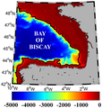
Bay of Biscay bathymetry.png 320 × 337; 102 KB
-
Colonial Rule in Africa 1914.jpg 484 × 563; 82 KB
-
Dye Stations in Greenland.jpg 385 × 268; 110 KB
-
Ice cap.jpg 230 × 170; 11 KB
-
Icefield.jpg 230 × 220; 8 KB
-
Intro image.jpg 366 × 252; 34 KB
-
Last Glacial Maximum Susquehanna River drainage.png 690 × 729; 658 KB
-
Late Roman Egypt and Surrounding Provinces.jpg 662 × 495; 291 KB
-
Locations of Chesapeake Bay laurel leaf bifaces.png 678 × 730; 490 KB
-
Map-1000bc-argonauts.jpg 359 × 386; 42 KB
-
Mill Bay Stronsay March 2008.jpg 350 × 233; 19 KB
-
North Sea continental shelf.jpg 600 × 752; 148 KB
-
Northwest edge of the continental shelves.png 728 × 680; 394 KB
-
Platinum spikes.jpg 1,600 × 1,116; 192 KB
-
Roskilde area.png 1,003 × 432; 371 KB
-
Stations-1.jpg 2,616 × 1,614; 1.43 MB
-
Submissioner Grønland hjemmeside.png 620 × 867; 781 KB
-
The Europe That Was.jpg 564 × 837; 106 KB
-
The Real Map of Ireland.jpg 1,200 × 913; 199 KB
-
Thermokarst lakes.jpe.jpeg 379 × 248; 61 KB
-
ThermokarstGlossary.jpg 350 × 263; 39 KB