File:F41088a1-crop.jpg
Jump to navigation
Jump to search

Size of this preview: 542 × 600 pixels. Other resolutions: 217 × 240 pixels | 434 × 480 pixels | 694 × 768 pixels | 925 × 1,024 pixels | 1,410 × 1,560 pixels.
Original file (1,410 × 1,560 pixels, file size: 995 KB, MIME type: image/jpeg)
Summary[edit | edit source]
| Description |
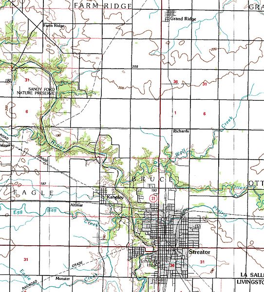
Crop of a USGS 1:100,000 topo map, showing Streator and Kangley IL. |
|---|---|
| Source |
http://www.isgs.uiuc.edu/nsdihome/webdocs/drgs/drg_100k/utm_byzone/drg_usgs_f41088a1.zip |
| Date | |
| Author |
ISGS UIUC NSDI |
| Permission (Reusing this file) |
See below.
|
Licensing[edit | edit source]
| This file was released into the public domain by the copyright holder, its copyright has expired, or it is ineligible for copyright. This applies worldwide.
Content released into the public domain may be used for any purpose without attribution, including commercial activities and creation of derivative works. |
File history
Click on a date/time to view the file as it appeared at that time.
| Date/Time | Thumbnail | Dimensions | User | Comment | |
|---|---|---|---|---|---|
| current | 21:28, 17 October 2008 |  | 1,410 × 1,560 (995 KB) | Una Smith (discuss | contribs) | |
| 04:16, 15 October 2008 |  | 1,270 × 1,223 (751 KB) | Una Smith (discuss | contribs) | Crop of [http://www.isgs.uiuc.edu/nsdihome/webdocs/drgs/drg_100k/utm_byzone/drg_usgs_f41088a1.zip this] USGS 1:100,000 topo map. |
You cannot overwrite this file.
File usage
The following page uses this file: