File:Großmugl - Hügelgrab (1).JPG
Jump to navigation
Jump to search
Size of this preview: 800 × 453 pixels. Other resolutions: 320 × 181 pixels | 640 × 363 pixels | 1,024 × 580 pixels | 1,280 × 725 pixels | 2,560 × 1,451 pixels | 4,961 × 2,811 pixels.
Original file (4,961 × 2,811 pixels, file size: 9.65 MB, MIME type: image/jpeg)
| This is a file from the Wikimedia Commons. The description on its description page there is shown below.
Commons is a freely licensed media file repository. You can help. |
Summary
| Description |
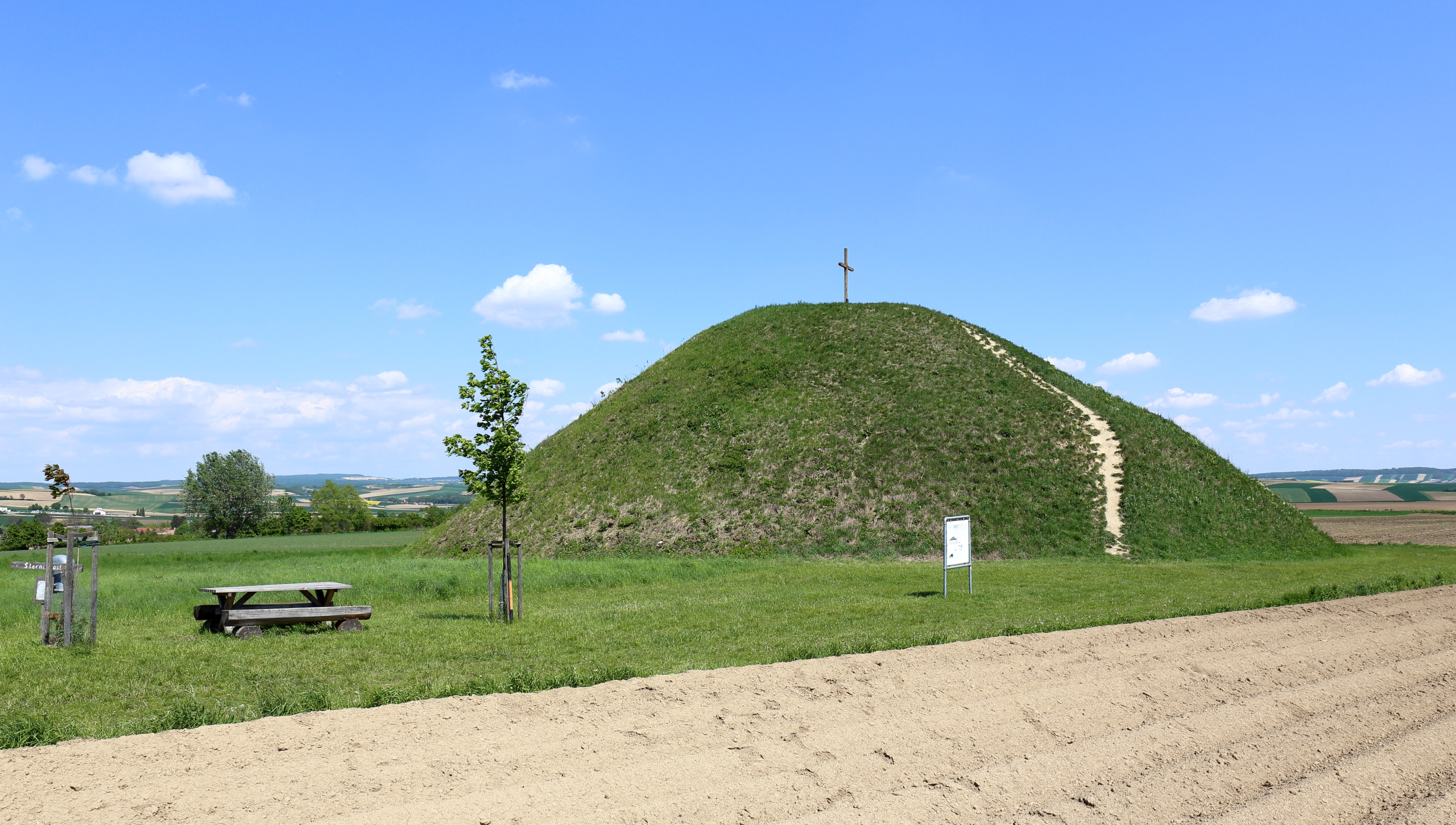
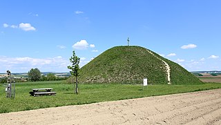
Deutsch: Hügelgrab bzw. Grabhügel (Tumulus), auch Leeberg von Großmugl bezeichnet, in der niederösterreichischen Marktgemeinde Großmugl.
Der Tumulus wurde während der Hallstattzeit (800 bis 450 v. Chr.) aufgeschüttet und ist mit einem Durchmesser von rd. 50 Meter und einer Höhe von etwa 14 Meter einer der Größten in Mitteleuropa. Das Hügelgrab ist auch namensgebend für den Ort Großmugl: «großer Mugl» (Hügel). |
| Date | |
| Source | Own work |
| Author | C.Stadler/Bwag |
| Permission (Reusing this file) |
Deutsch: Hallo, du darfst mein Foto kostenlos nutzen, aber nenne mich bitte als Fotograf, beispielsweise „Foto: C.Stadler/Bwag“ oder © C.Stadler/Bwag; CC-BY-SA-4.0. Auf mehr Angaben bestehe ich nicht - im Gegensatz zu manch anderen, die die Vorgaben der unten angeführten Lizenzierung auf Punkt und Beistrich einfordern. English: Feel free to use my photos, but please mention me as the author like © C.Stadler/Bwag or © C.Stadler/Bwag; CC-BY-SA-4.0 (that's good enough) and if you want send me a message: bwag@gmx.net. |
| Other versions |
|
.JPG)
.JPG)
.JPG)
| Camera location | | View this and other nearby images on: OpenStreetMap |
|---|
.JPG¶ms=048.488212_N_0016.222333_E_globe:Earth_type:camera_alt:263.7_source:exif_&language=en)
Licensing
I, the copyright holder of this work, hereby publish it under the following license:
This file is licensed under the Creative Commons Attribution-Share Alike 4.0 International license.
- You are free:
- to share – to copy, distribute and transmit the work
- to remix – to adapt the work
- Under the following conditions:
- attribution – You must give appropriate credit, provide a link to the license, and indicate if changes were made. You may do so in any reasonable manner, but not in any way that suggests the licensor endorses you or your use.
- share alike – If you remix, transform, or build upon the material, you must distribute your contributions under the same or compatible license as the original.
File history
Click on a date/time to view the file as it appeared at that time.
| Date/Time | Thumbnail | Dimensions | User | Comment | |
|---|---|---|---|---|---|
| current | 14:19, 10 May 2016 | | 4,961 × 2,811 (9.65 MB) | Bwag | {{Information |Description= {{de|1=Hügelgrab bzw. Grabhügel (Tumulus), auch Leeberg von Großmugl bezeichnet, in der niederösterreichischen Marktgemeinde Großmugl.<br/>Der Tumulus wur... |
File usage
The following 4 pages use this file:
Global file usage
The following other wikis use this file:
.JPG)