File:Geotagged articles in English Wikipedia.png
Jump to navigation
Jump to search
Size of this preview: 800 × 470 pixels. Other resolutions: 320 × 188 pixels | 640 × 376 pixels | 1,024 × 601 pixels | 1,280 × 752 pixels | 3,351 × 1,968 pixels.
Original file (3,351 × 1,968 pixels, file size: 920 KB, MIME type: image/png)
| This is a file from the Wikimedia Commons. The description on its description page there is shown below.
Commons is a freely licensed media file repository. You can help. |
Summary
| Description |
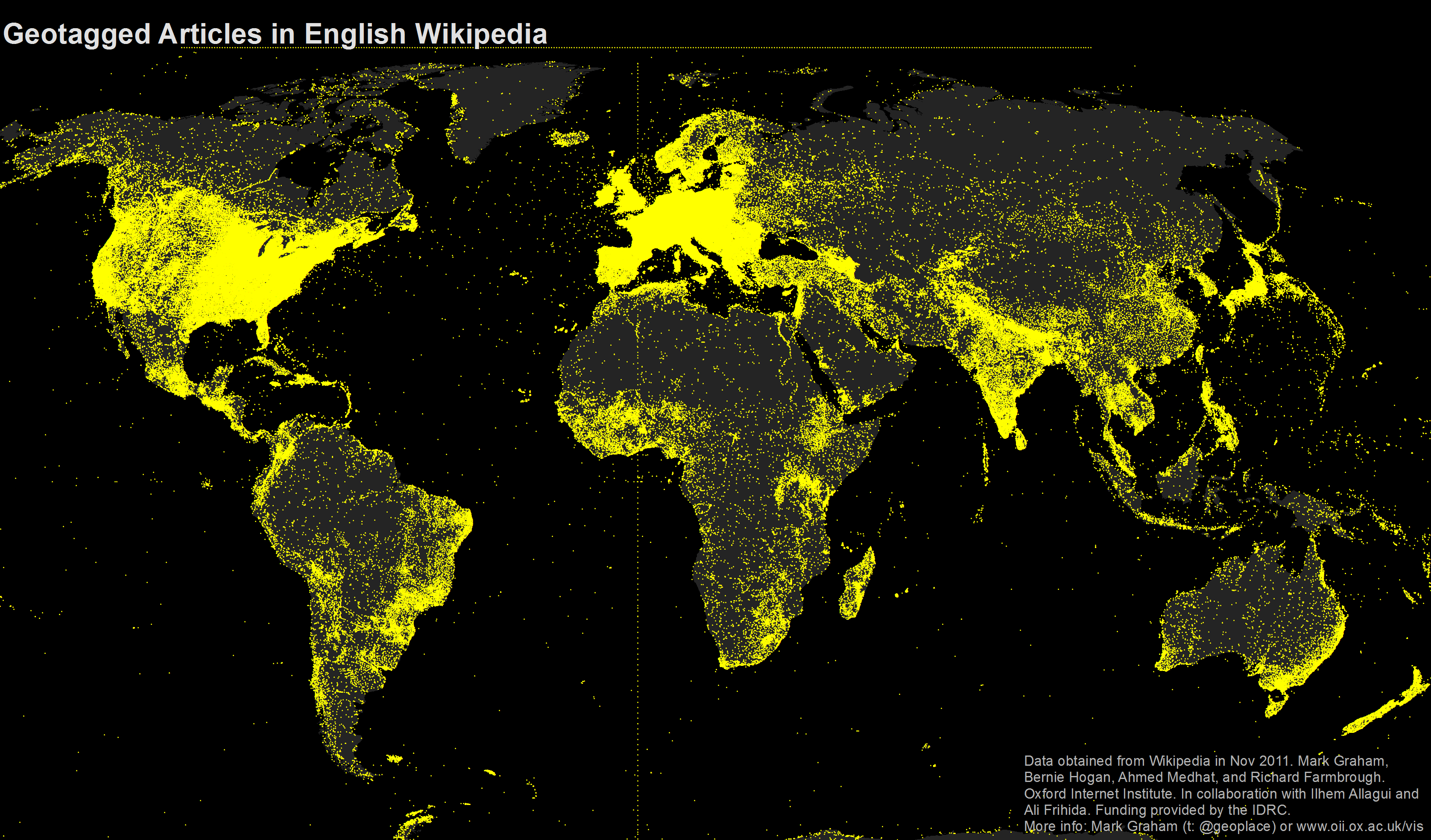
English: A map of all geotagged articles in the English Wikipedia. Data from the November 2011 data dump. More info is available from the author at http://www.zerogeography.net/2011/11/mapping-wikipedias-augmentations-of-our.html or (@geoplace) |
| Date | |
| Source | Own work |
| Author | Markgraham |
Licensing
I, the copyright holder of this work, hereby publish it under the following license:
This file is licensed under the Creative Commons Attribution-Share Alike 3.0 Unported license.
- You are free:
- to share – to copy, distribute and transmit the work
- to remix – to adapt the work
- Under the following conditions:
- attribution – You must give appropriate credit, provide a link to the license, and indicate if changes were made. You may do so in any reasonable manner, but not in any way that suggests the licensor endorses you or your use.
- share alike – If you remix, transform, or build upon the material, you must distribute your contributions under the same or compatible license as the original.
File history
Click on a date/time to view the file as it appeared at that time.
| Date/Time | Thumbnail | Dimensions | User | Comment | |
|---|---|---|---|---|---|
| current | 11:05, 11 November 2011 | | 3,351 × 1,968 (920 KB) | Markgraham |
File usage
The following page uses this file:
Global file usage
The following other wikis use this file:
- Usage on de.wikipedia.org
- Usage on en.wikipedia.org
- Usage on fr.wikipedia.org
- Usage on fr.wikiversity.org
- Usage on vep.wikipedia.org
- Usage on zh.wikipedia.org