File:Finland-CIA WFB Map.png
Jump to navigation
Jump to search
Size of this preview: 276 × 600 pixels. Other resolutions: 110 × 240 pixels | 328 × 713 pixels.
Original file (328 × 713 pixels, file size: 24 KB, MIME type: image/png)
| This is a file from the Wikimedia Commons. The description on its description page there is shown below.
Commons is a freely licensed media file repository. You can help. |
| Description |
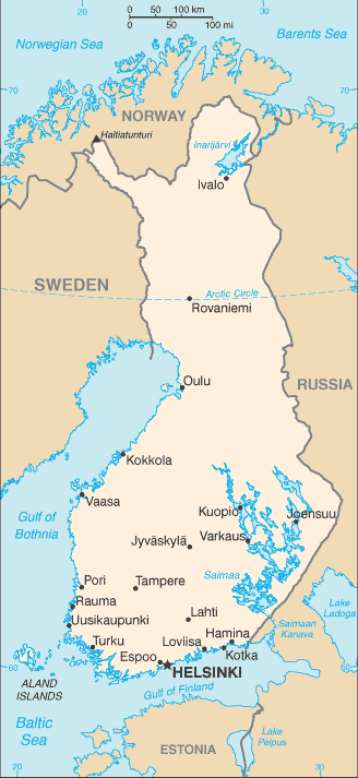
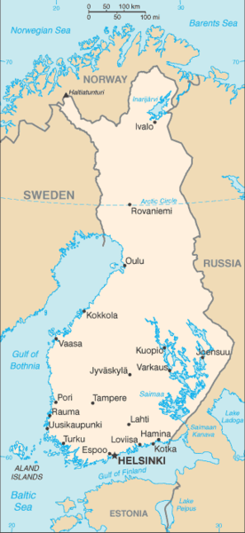
English: A map of Finland, showing major cities. |
|||
| Date | published 2004 | |||
| Source | CIA, The World Factbook, 2004. | |||
| Author | unknown cartographer | |||
| Permission (Reusing this file) |
|

| Annotations | This image is annotated: View the annotations at Commons |
File history
Click on a date/time to view the file as it appeared at that time.
| Date/Time | Thumbnail | Dimensions | User | Comment | |
|---|---|---|---|---|---|
| current | 09:13, 27 March 2005 | | 328 × 713 (24 KB) | Wolfman~commonswiki | {{CIA-map}} |
File usage
The following page uses this file:
Global file usage
The following other wikis use this file:
- Usage on ar.wikipedia.org
- Usage on az.wikipedia.org
- Usage on be-tarask.wikipedia.org
- Usage on bg.wiktionary.org
- Usage on bn.wikipedia.org
- Usage on bs.wikipedia.org
- Usage on ca.wikipedia.org
- Usage on co.wikipedia.org
- Usage on de.wikipedia.org
- Usage on de.wikinews.org
- Usage on el.wikipedia.org
- Usage on en.wikipedia.org
- Usage on en.wikisource.org
- Usage on en.wiktionary.org
- Usage on fa.wikipedia.org
- Usage on fi.wikipedia.org
- Usage on gag.wikipedia.org
- Usage on gl.wikipedia.org
- Usage on gom.wikipedia.org
- Usage on hi.wikipedia.org
- Usage on hr.wiktionary.org
- Usage on hu.wikipedia.org
- Usage on hu.wiktionary.org
- Usage on ilo.wikipedia.org
- Usage on ja.wikipedia.org
- Usage on ka.wikipedia.org
- Usage on kn.wikipedia.org
- Usage on ko.wiktionary.org
- Usage on lb.wikipedia.org
- Usage on lt.wiktionary.org
- Usage on mi.wikipedia.org
- Usage on ml.wikipedia.org
View more global usage of this file.