File:BeaufortSeaBathymetry.jpg
Jump to navigation
Jump to search
No higher resolution available.
BeaufortSeaBathymetry.jpg (359 × 369 pixels, file size: 47 KB, MIME type: image/jpeg)
| This is a file from the Wikimedia Commons. The description on its description page there is shown below.
Commons is a freely licensed media file repository. You can help. |
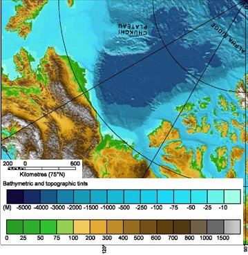
| Description | Topography of the Beaufort Sea area |
| Date | (UTC) |
| Source | |
| Author |
|
This image is in the public domain because it contains materials that originally came from the U.S. National Oceanic and Atmospheric Administration, taken or made as part of an employee's official duties.
|
Original upload log
This image is a derivative work of the following images:
- File:IBCAO_betamap.jpg licensed with PD-USGov-NOAA
- 2007-08-02T00:29:14Z Mikkalai 762x868 (726688 Bytes) Source: http://www.ngdc.noaa.gov/mgg/image/IBCAO_betamap.jpg Bathymetric map of the [[w:Arctic Ocean]]
Uploaded with derivativeFX
File history
Click on a date/time to view the file as it appeared at that time.
| Date/Time | Thumbnail | Dimensions | User | Comment | |
|---|---|---|---|---|---|
| current | 07:24, 21 September 2010 | | 359 × 369 (47 KB) | Materialscientist | {{Information |Description=Topography of the Beaufort Sea area |Source=*File:IBCAO_betamap.jpg |Date=2010-09-21 07:23 (UTC) |Author=*File:IBCAO_betamap.jpg: noaa.gov *derivative work: ~~~ |Permission= |other_versions= }} {{self|PD-USGov-NOAA} |
File usage
The following page uses this file:
Global file usage
The following other wikis use this file:
- Usage on en.wikipedia.org
- Usage on hr.wikipedia.org
- Usage on ml.wikipedia.org
- Usage on ur.wikipedia.org
- Usage on uz.wikipedia.org
- Usage on vi.wikipedia.org
- Usage on www.wikidata.org