Category:Stratigraphy images
Jump to navigation
Jump to search
Media in category "Stratigraphy images"
The following 74 files are in this category, out of 74 total.
-
 Aalenian type strata.png 495 × 376; 243 KB
-
 Aalenian zones.png 542 × 304; 62 KB
-
 Abereiddian placement.png 869 × 1,051; 190 KB
-
 Actonian position.png 714 × 808; 380 KB
-
 Adelaidean upper.png 912 × 668; 330 KB
-
 Aegean occurrence.png 957 × 745; 254 KB
-
 Aeronian GSSP.png 997 × 502; 172 KB
-
 Aeronian lower GSSP.png 491 × 484; 440 KB
-
 Ammonite zones Edmontonian.png 573 × 681; 165 KB
-
 Anisian chart.png 963 × 668; 242 KB
-
 Benthic and planktonic isotope records Monte Gibliscemi section.png 562 × 504; 127 KB
-
 Bentonite Christidis Huff.jpg 1,280 × 960; 273 KB
-

-
 Black mat (12.9 ka) Murray Springs Clovis site in Arizona.jpg 600 × 402; 85 KB
-
 Calabrian base GSSP at e.png 685 × 406; 455 KB
-
 Calabrian base GSSP.png 1,326 × 995; 614 KB
-
 Calibration magnetostratigraphy geomagnetic polarity time scales.png 509 × 1,402; 137 KB
-
-
 Closeup of K-Pg boundary.png 289 × 294; 164 KB
-
 Congelation ice.jpg 230 × 288; 30 KB
-
 Correlation chart of the Cambrian.png 1,068 × 738; 264 KB
-
 Danian base GSSP.png 1,062 × 667; 228 KB
-
 Dead ice below sandur deposits3.JPG 1,632 × 1,224; 507 KB
-
 Diagram Frasnian Famennian GSSP.png 904 × 247; 107 KB
-
-
 Dp-pictures-vims-studies-sediment-core-samples-004.jpeg 647 × 432; 127 KB
-
 Ediacaran base GSSP.png 484 × 1,378; 632 KB
-
 Famennian base GSSP.png 892 × 579; 455 KB
-
 Gelasian base GSSP.png 524 × 357; 166 KB
-
 General stratigraphy of the Mozaan Group of the Pongola Supergroup.png 1,206 × 1,006; 192 KB
-
 Geologic Time Scale 2004.png 771 × 688; 137 KB
-
 Geotechnical boring MD99-2289.png 331 × 673; 73 KB
-
 Gilbert chron base.png 635 × 934; 319 KB
-
 Greyish red siltstone unit.jpg 644 × 478; 109 KB
-
 Guzhangian base GSSP.png 408 × 314; 279 KB
-
 Holocene GSSP base.png 854 × 651; 394 KB
-
 Holocene stratigraphic column.jpg 350 × 506; 28 KB
-
 Inclination against depth and polarity chrons.jpg 520 × 930; 62 KB
-
 Induan base GSSP.png 491 × 318; 176 KB
-

-
 International Chronostratigraphic Chart.png 2,360 × 1,659; 913 KB
-
 Key agnostoid trilobite species.png 394 × 654; 272 KB
-
 Lithostratigraphy of the Lower and Middle Lias.png 910 × 513; 129 KB
-

-
 Magnetostratigraphy and calibration to GPTS.png 532 × 740; 168 KB
-
 Messinian GSSP.png 753 × 430; 417 KB
-
 Miocene chrons.png 87 × 557; 24 KB
-
 Neogloboquadrina pachyderma.jpg 726 × 429; 88 KB
-
 NH DTB-MSG profile to edge of Storegga Slide.png 875 × 899; 356 KB
-
 Norian chart.png 926 × 859; 239 KB
-
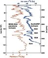 NorthGRIP and foraminifera.jpg 506 × 618; 70 KB
-

-
 Ojo Alamo.jpg 418 × 368; 43 KB
-
 Older Dryas.jpg 518 × 706; 101 KB
-
 P915280.png 1,125 × 1,460; 224 KB
-
 P915341.png 1,048 × 1,460; 482 KB
-
 Photograph of the Serravallian-Tortonian boundary interval.png 467 × 276; 162 KB
-
 Polarity Langhian Burdigalian.png 1,023 × 570; 320 KB
-
 Pollen diagram Roskilde Fjord (RF6).png 1,007 × 586; 438 KB
-
 Pre-Illinoisian sections.png 718 × 688; 738 KB
-
 Profile and core (MD99-2289 and 6404-5) locations.png 1,034 × 372; 364 KB
-
 Proposed correlation Huronian Supergroup and the upper Transvaal Supergroup.jpg 1,280 × 810; 184 KB
-
 Ras il Pellegrin section.png 627 × 580; 375 KB
-
 Ridging 0.jpg 230 × 152; 5 KB
-
 Smithian in Utah.png 1,094 × 594; 120 KB
-
 Steeply-tilted Layers of Flysch, Flysch Cliffs, Basque Coast.jpg 1,300 × 867; 358 KB
-
 Stratigraphic column dinosaur NM.jpg 830 × 1,407; 458 KB
-
 Telychian lower GSSP.png 482 × 415; 388 KB
-
 Triassic-Jurassic boundary.png 504 × 744; 821 KB
-
 VIMS sediment core.png 397 × 400; 235 KB
-
 Visean Tournaisian boundary.png 864 × 606; 490 KB
-
 Whitehill Formation stratigraphy.jpg 948 × 497; 159 KB
-
 Wohlfarth Boreas timelines.jpg 853 × 936; 152 KB
-
 Zanclean base GSSP.png 499 × 487; 329 KB


_of_the_Western_Interior_of_North_America.png)
_Murray_Springs_Clovis_site_in_Arizona.jpg)


_to_show_indicators_of_aquatic_environmental_change.png)


.png)


_locations.png)